I found 544 results for valtellina

Walking through time between Grosio and Grosotto

The most extensive historiated rock in Europe
Walking through time between Grosio and Grosotto

Tibetan bridges, the attraction of height without the risk

Four suspension bridges in Lombardy
Ponti tibetani, il fascino dell’altezza senza rischi

Cycling from Morbegno to Colico

An itinerary, along the Adda River, where it is possible to relive history thanks to the presence of two ancient forts that can be visited, one dating back to the time of Spanish rule and one built just before the outbreak of World War I.   Mountainous reliefs will frame the route, which will end on the shores of Lake Como, also known as Lario. The route starts from Morbegno station and ends at Piona station. From Morbegno station we arrive in the center by reaching the ancient bridge that crosses the Bitto stream. We continue until we reach Via Nazionale and then find a traffic circle, which is near the railway crossing. On the left, after the railway, we follow the signs until we reach a suspension bridge to cross to the other side. At the next traffic circle we take Via Carlo De Magistris, which we take uphill, and on the left Via Roma. The route continues on secondary roads to the Pian di Spagna Reserve and Lake Mezzola. Then we reach the bridge over the Adda River, which we follow until we reach Piona. ITINERARYDistance: 33.2kmDifficulty level: mediumRoad surface: asphalt and dirtElevation gain:+355m, -329m (Max slope: 18.9%, -20.6%; Average slope: 1.7%, 1.7%)Suitable for: allRecommended type of bike: allAverage duration: 3 h approx. AT LEAST FIVE POINTS OF INTEREST Morbegno Civic Museum of Natural HistoryThe Civic Museum was established by the municipality of Morbegno on March 14, 1974, thanks to the efforts of a local collector, Giacomo Perego (1922-2008), who donated the initial core of collections.Useful info: Museum opening hours: Tuesday, Thursday, Friday Saturday and Sunday from 2:30 to 5:30 pm.Website: www.sistemamusealevaltellina.itPhone: 0342-612451 Pian di Spagna and Lake Mezzola Nature Reserve.The small plain (about 1,600 hectares) stretches at the confluence of the Valtellina and Valchiavenna. Majestic mountains and two lakes (Lake Mezzola and Lake Como) border this distinctive flat area.Useful info: http://www.piandispagna.it/Phone: 0344-84251 Fuentes FortThe 17th-century Spanish fort was commissioned by the Governor of the State of Milan, Pedro Enriquez de Acevedo Count of Fuentes, to extend his dominion from Valtellina and Valchiavenna to Upper Lake Como.Useful info: Opening hours: 10 am to 6 pm, only on specific days decided by the province of Lecco. For more information: https://www.fortedifuentes.it/ Fort Montecchio NorthBuilt in a few months, just before the outbreak of World War I, it is the best preserved in Europe. Its visit allows us to understand the austere martial life of the place at the time of the conflict.Useful info: https://www.fortemontecchionord.it/index.php?lang=itPhone: 0341-940322 Piona AbbeyThe priory of Piona is situated on the Olgiasca peninsula, immersed in an atmosphere of peace and serenity and where Cistercian monks still reside today. The church, in Romanesque style, dates from 1138 and is dedicated S. Maria.Useful info: Via Abbazia di Piona, 55 in Colico (LC)Hours: Monday to Sunday - 09:00-12:00, 14:30-18:00Tel: 0341-940331Website: https://www.abbaziadipiona.it/
Morbegno to Colico

5 Thing-to-do in Colico

The perfect place for your outdoor holiday on Lake Como
colico cose da fare

Along the Tees, in the valley of the sheep

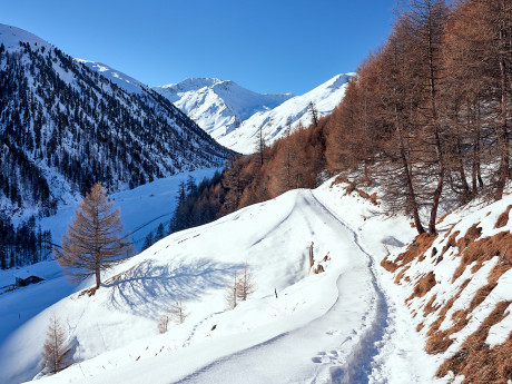
This itinerary is characterized by the presence of the Tee, very atmospheric old wooden dwellings used in the past by shepherds during the summer period, now largely restored. The Tees are characteristic of the Federia Valley, a valley little frequented in winter since it lacks ski lifts and ski slopes but which deserves to be known and experienced for its splendid snowy landscapes. The trail that will feature them can be easily walked with snowshoes on your feet, along a clearly visible path that is constantly marked by green and red poles. The ideal time to start the trail is mid-morning when the sun shines on it and the air warms up; moreover, the valley lies behind a high promontory that, in the winter season, hides the sun as early as around 2 p.m., while the valley flooris never irradiated. It is advisable not to overdress for the first stretch since it is very sunny and uphill, but to cover up well on the return stretch since the temperature difference is significant. Val Federia literally means "the valley of the sheep," in fact in the not-so-distant past this area was mainly managed by shepherds whose pastures extended over nearly 63,000 hectares. The valley was also an area of great commercial value due to the numerous mountain passes, the most important of which is the Cassana Pass. The latter connects the Livigno area with the Engadine, a pass rich in history especially in the context of the Valtellina Wars (1620-36) in which the three Grey Leagues attempted to retake Valtellina and the Contadi di Chiavenna and Bormio after the 1620 uprising of Catholic nobles. One must leave one's car at the P3 parking lot in Ponte Calcheira, then walk along the road for a few tens of meters until reaching, on the right, the beginning of the path appropriately marked by a green sign with the symbol for snowshoe routes. Going uphill into the beautiful larch forest flanked by the Valle del Saliente stream, you follow the path without any difficulty, being clearly visible and marked thanks to the green-colored sign posts. The first part of the ascent is rather steep but nothing challenging, and in a short time, after a relaxing hike through the woods, you come out into the open skirting the first characteristic wood and stone huts. The slopes in this section become easier and, as you climb, the alpine landscape opens to 360 degrees giving unique emotions. Behind you can admire the northernmost side of Livigno set by snow-capped mountains, but the most spectacular view is the one that opens up in front of you and that reveals itself little by little along the walk showing the valley at every angle. Along the way you can see the footprints left in the snow by wild animals, and, for the more enthusiastic, it is fun to try to find out which species they belong to.Reaching the highest part of the walk, about 2050 m above sea level, the trail continues slightly downhill, soon entering a larch forest. Once you get out of the forest, you pass some huts: in the distance, at the bottom of the valley, with its 3050 m altitude towers Pizzo del Leverone whose view leaves you speechless. A few souvenir shots and you continue until you reach a left turn, just beyond a beautiful Tea, the Tea da Memi, a pleasant refreshment point where you can enjoy traditional, homemade dishes.At this point the section that leads back to the parking lot begins. In the first few meters you have to pay some attention because the path continues along a short but steep descent. When you reach the bottom, you turn left, skirting the road for a short distance at first, after which, just before the beautiful little church of Federia, you usually have to take off your snowshoes since you have to continue for about 500 meters along the road, which is completely frozen in winter. Just before a nucleus of huts, on the right is the green marker indicating the final section of the trail, you must put your snowshoes back on and continue downhill along the Federia stream until you reach the Calcheira bridge from where the walk began. Important: According to new regulations, for ski mountaineering and snowshoeing activities, starting January 1, 2022, it is mandatory to carry the Artva device including rescue shovel and probe (for possible avalanche or avalanche danger).
Along the Tees, in the valley of the sheep

Valdidentro

In Valdidentro there are many attractions and activities to do for the whole family, not to be missed!
Valdidentro (SO)

Reaching New Heights in Lombardy

Suggestions for high altitude excursions.
Toccare il cielo con un dito: le cime più alte della Lombardia

Teglio- San Martino- Murenken- St. Anthony walk.

It is possible to leave the car in the large parking lot in front of the cemetery of Teglio. You then walk a few meters on the provincial road in the direction of the village of Teglio. Near a grove of conifers (with specimens of cedar, spruce, douglas fir), there is a small rest area with a table and benches, from which a small road directed toward the bottom of the valley starts, paved for a short stretch. Upstream, the bell tower of St. Martin's Church can be seen. Near the access to a private area, you descend to the left along a dirt road and, having traveled a few dozen meters, you find yourself among meadows and woods in the locality of Murenken. At the next fork, near a birch grove, you proceed to the right and then cross some meadows and fields. You then skirt, for a short distance, an old mule track, which you later join, entering a chestnut forest. The road descends steeply, until it reaches the paved track of the provincial road that leads from Chiuro to Teglio; from this poastation, there is a wonderful view of the entire central portion of Valtellina. Turn left and walk a short downhill stretch on asphalt toward the clearly visible church of Sant'Antonio, later taking the small asphalt road that, at the end of the hairpin bend you have just traveled, descends to the left and then to the church. Continue in the direction of the built-up area of Teglio and reach the built-up area of the Sant'Antonio district. Near a stone-covered fountain, you take a steep concrete road that you follow, leaving the fountain to your left. Noteworthy is the wall fresco of a votive character in the vicinity. You then turn left, continuing a few more meters on concrete and then turning right, still on concrete, overcoming a short very steep section. You then come to the dirt road and, leaving the last houses of Sant'Antonio, continue alongside an apple orchard, still in the direction of Teglio. Upstream of a high-tension pylon, continue straight ahead again in the direction of the power line. You then reach a new dirt track and take a left, leaving a small bridge on your right. You then climb rapidly toward the provincial road, which you reach near a dwelling. Turn left and walk a few dozen meters to find yourself back at the starting point. Difficulty: easyType: loopWalking time: 1 hour and 40 minutesSuitable for families with children

Teglio walk- Verida- Palama- Ravarola- Teglio

Simple walk through the characteristic rural mid-mountain environment, where cultivated fields, meadows, vineyards and orchards alternate. Depending on the season, typical tellin crops of potatoes, barley, rye and buckwheat can be seen.

Gema promenade- source of the Frascesca

Easy route and especially suitable for families with children
Source Frascesca

Ca' branchi walk- Somasassa- Caven- Tresenda

Difficulty: easyType: mixedWalking time: 2 hours and 30 minutesSuitable for families with children From the town of Teglio, follow the provincial road toward Tresenda to the hamlet of Ca' Branchi, where you take the road that descends to the left, following the signs for the Somasassa lake. You can leave your car at the parking lot of the sport fishing lake. You take the dirt road that descends into the valley and, after a few dozen meters, you can admire an ancient and extensive chestnut orchard. After about 500 meters, you can see to your right the bell tower of the church of San Gottardo, while on the Orobic side, you can see the hamlet of Carona and, further to the right, nestled between two slopes, the bell tower of the hamlet of Bondone. Detour to CavenAt the beginning of the concrete road, you take the path on your right that descends steeply into the valley, winding through terraced vineyards where Valgella wine, a prestigious Valtellina Superiore docg, is produced. It was precisely at these terraced vineyards that the Caven stelae were found, prehistoric artifacts of great value, which can be viewed today in the rooms of Palazzo Besta. Now begins a downhill stretch, which continues above the hamlet of Tresenda, towards the end of which one can admire to one's left a stump of celtis australis (hackberry tree) set in a jagged rocky portion. Continuing slightly uphill, the area planted with vines gives way to orchards-apple orchards in particular-and ancient terraces of chestnut trees. After about 1,300 m, the trail reaches a vantage point on the eastern part of the valley, where the settlements of Boalzo, Bianzone, Villa di Tirano, Tirano (overlooked by the mass of Mount Massuccio) and, at the bottom, the Sernio cone can clearly be seen rising in succession. At a stream, the return route begins. At the junction with the road leading from Balzo to Teglio, continue left, skirting the stream and on the hairpin bend continue on the asphalt road slightly uphill. Tackling the two uphill hairpin bends, a large chestnut forest opens up, an ideal spot for a short shady stop. At the fork that follows, you continue left following the main road and, on your right, you can admire an ancient votive chapel. You then emerge again at the Somasassa plain. At the fork, you can choose whether to continue to the left and indulge in a visit to the village of Somasassa, or to continue to the right, taking you back to the starting point. After about 20 minutes of walking, you will take the dirt path on the left that skirts Somasassa Lake and leads back to the parking lot. Click the link below to find out the next route!
Somasassa

Santa Caterina Valfurva

Thirty-five kilometres of slopes for every level of difficulty
Santa Caterina Valfurva - Parco Nazionale dello Stelvio