I found 544 results for valtellina

Livigno

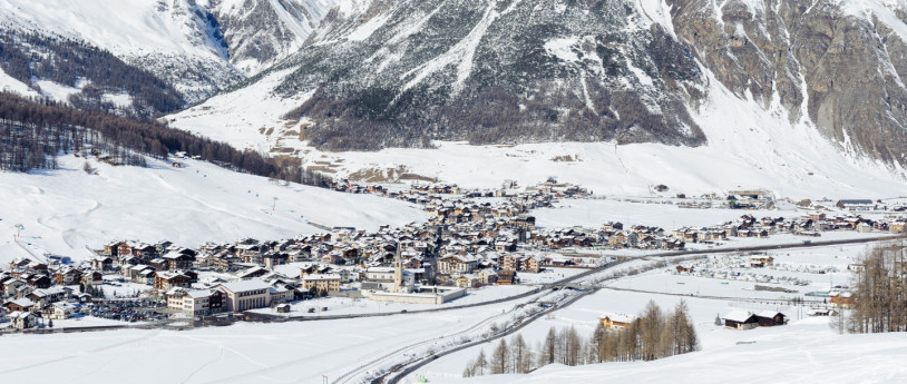
Situated amongst the nature parks of Stelvio and Engadina, Livigno is one of the best equipped winter resorts in Europe.
Livigno - inLombardia

Winter in Lombardy

Sled dog, Bormio, Sondrio - @inLombardia

Bernina Rezia Rhaetian Train

Trenino Rosso del Bernina

Cycling from Tresenda to Prato Valentino

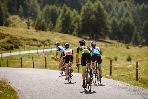
Highest point 1685 mTotal elevation gain 1310 mTotal elevation loss 1310 mTotal climb 16,5 kmTotal descent 12 kmTotal distance 28,5 kmDuration 3 - 4 hCycling rate (%) 100% The ascent to Prato Valentino is the same paved road as track n°  33,  starting  from  Tresenda  rather  than  San  Giacomo.  you  can avoid some traffic congested road taking alternative roads that go up from Castelvetro to Vangione and then from Frigeri to the road that leads to San Rocco.Going  right  afterwards  you  meet  the  ascent  from  Teglio  to  Prato. This paved road, especially in the last part, is very hard. From  Prato  Valentino  starts  the  descent.  This  can  also  be  an  option  for  whom,  doing  trail  n°  10  from  Col  D’Anzana,  wants  to descend downstream quickly. The descent is really easy, on a  reasonably  steep  gravel  road  to  Teglio.  Afterwards  the  trail  features    gravel  road  sections,  (few)  paved  road  sections  and  cemented  ones    among  the  vineyards  above  Tresenda.  From  Prato to Teglio you can follow the signs reporting n° 391- Piazza S. eufemia. Approximately 1,5 km after you have started the descent – in  order  to  avoid  a  rather  hard  section  of  the  single  trail -  you’d  better  not  turn  left  (crossroad  S.Sole-brigna),  but  carry on till the mountain huts bollone, take for a short section the  ascending  trail  and  after  the  first  hairpin  go  back  on  the  gravel road  on the left. Once in Teglio descend to Sommasassa  passing  Palazzo  besta,  run  along  the  namesake  lake,  pass  the  San  Gottardo  little  church  and  start  the  beautiful  descent  among the vineyards that takes back to Tresenda.
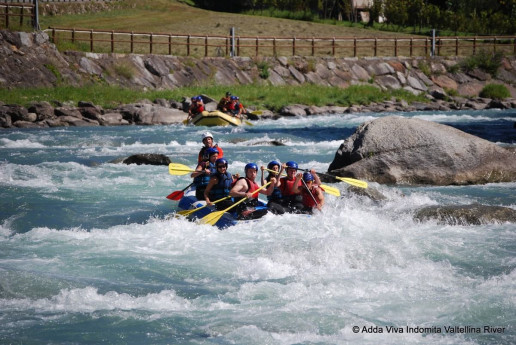
ExtremeFun Rafting Adventure

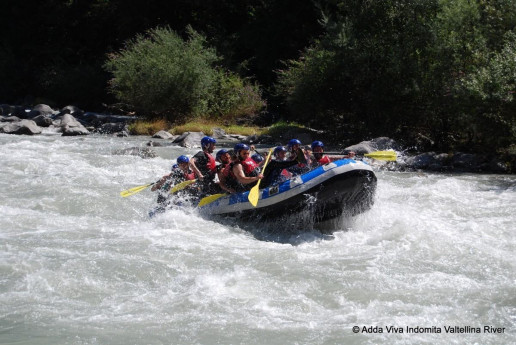
Every time you go rafting you have a different experience: river conditions change quite fast, forcing rafters to react quickly; this is the fun part of this sport! Every run is a different experience, so it's impossibile to get bored! ExtremeFun is an experience thought to provide the highest level of fun for our clients, regardless of their age. With this rafting tour you'll test your abilities through little games that will grant you plenty of adrenaline! Difficulty: suitable for everyone, it's not required to be experienced swimmers. Length: 2:45 hours. Notes: There might be variations, depending of water conditions. Rates 1 Day € 49
ExtremeFun Rafting Adventure

Adrenaline Rafting: Master the Waters

“Adrenaline Rafting” is one of our most challenging experiences, are you ready for it? It takes place in a stretch of the Adda river with level 4 rapids, aspect that requires a good water flow to have fun in complete safety! Our guides will be at your disposal and few safety kayakers will follow you during the experience. Difficulty: suited for people over the age of 14, it's not required to be expert swimmers. Length: 2:15 hours Notes: there might be variations due to river conditions. Rates 1 Day € 55
Adrenaline Rafting: Master the Waters

Hydrospeed Adrenaline: Upgrade to The Next Level

if you deem rafting as “too bland”, then the hydrospeed is probably what you're after! Rapids, waves, surf, strong currents and a lot more are waiting for you: it's a true flow of adrenaline! Prior to the experience you'll be instructed by experienced guides, so pay close attention! Difficulty: you need to be above the age of 18. Notes: variations might occur, due to river conditions Length: 2:20 hours. Price per person. Rates 1 Day € 55
Hydrospeed Adrenaline: Upgrade to The Next Level

Hydrospeed Extreme: Are You Ready For a True Challenge?

So you've already tried the hydrospeed and still you're not quite satisfied? Do you want something more? Do you really want to be invested by adrenaline? Try our extreme adventure! This experience is really intense, definitely suited only for those who're already familiar with the hydrospeed: you'll really be tested here! Age limit: 18 years old or above. Note: variations might occur according to river conditions. Length: 3 hours. Price per person. Rates 1 Day € 65
Hydrospeed Extreme: Are You Ready For a True Challenge?

Lombardy on the road..

Lombardy: wonderful views to see on the road.
Lombardy on the road

Cycling from Aprica to Val Belviso

Highest point 2320 mTotal elevation gain 1550 mTotal elevation loss 1550 mTotal climb 18 kmTotal descent 16,5 kmTotal distance 25,4 kmDuration 6-8 hCycling rate (%) 80% This route extends wholly through a valley belonging to the Orobic Alps.  Val  belviso  is  the  last  eastern  valley,  it  is  long,  deep  and  nar-row, but along the path going south from Alpe Magnolta to Passo di Venerocolo it seems bright and wide. The outline of Monte Torena  –  the  last  high  peak  of  Orobic  Alps  –  dominates  the  other  side  westwards reflecting its shape into the waters of the huge artificial lake on the valley bottom. Once you get to the pass dividing us from the  Province  of  bergamo,  you  will  find  some  alpine  lakes  wedged  among  the  rocks  and  the  grassy  small  hills.  The  descent  runs  on  a  trail at first and then turns into a dirt road through the whole valley, both alongside the lake and under the dam. In San Paolo the Rifugio Cristina is a nice place to grab calories and shelter. You can  start  from  the  car  park  nearby  Magnolta  ski  runs  and  take  the dirt road climbing up to the left of the cableway. The sign indicates  Malga  Magnolta  and  Passo  Venerocolo.  You  can  easily  cycle on the first half of the uphill dirt road, which then gets much steeper  from  the  mountain  huts  in  Corna  Alta  (1457  m)  to  the  finish  of  the  cableway  (1870  m),  so  that  you  may  need  to  carry  your  MTb.  This  is  a  challenging  ascent  but  in  summertime  you  can  use  the lift up to Magnolta. Halfway up the second ski lift, at 1940 meters, the track becomes a flat trail, which goes into the wood, turns south and enters Val belviso. you have to ride for about 13 km on a flat path going sometimes gently uphill, going past Malga Magnola (1997 m) and crossing the Valle del latte and the Valle di Pisa.  You have  to  pay  attention  to  some  exposed  stretches.  The  first  part  of  the  descent  from  Passo  di  Venerocolo  (2314  m)  to  the  dirt  road  at  2000 meters above Malga di Campo (1816 m) is steep and not very flowing. The downhill ride alongside the artificial lake and through the  remaining  part  of  Val  belviso  does  not  hinder  your  fun.  The  route ends with the ascent on a paved road from Ponte Ganda (906 m) to the resort town of Aprica.

The Via Spluga

The wonderful wilderness of the Spluga “sublime pass” and its route are in enclosed within a rugged and historically rich valley

Snowshoe walking in Prato Valentino: Anello Dosso Laù

Silenzio ovattato, inebriante profumo di bosco, tracce di animali selvatici sulla neve e fantastici panorami. È quanto si può godere compiendo un'attività fisica alla portata di tutti e poco dispendiosa: le escursioni con le racchette da neve.