I found 548 results for valtellina

Gema promenade- source of the Frascesca

Easy route and especially suitable for families with children
Source Frascesca

Ca' branchi walk- Somasassa- Caven- Tresenda

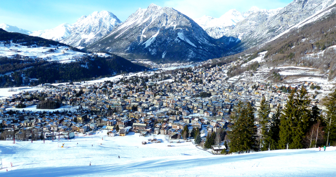
Difficulty: easyType: mixedWalking time: 2 hours and 30 minutesSuitable for families with children From the town of Teglio, follow the provincial road toward Tresenda to the hamlet of Ca' Branchi, where you take the road that descends to the left, following the signs for the Somasassa lake. You can leave your car at the parking lot of the sport fishing lake. You take the dirt road that descends into the valley and, after a few dozen meters, you can admire an ancient and extensive chestnut orchard. After about 500 meters, you can see to your right the bell tower of the church of San Gottardo, while on the Orobic side, you can see the hamlet of Carona and, further to the right, nestled between two slopes, the bell tower of the hamlet of Bondone. Detour to CavenAt the beginning of the concrete road, you take the path on your right that descends steeply into the valley, winding through terraced vineyards where Valgella wine, a prestigious Valtellina Superiore docg, is produced. It was precisely at these terraced vineyards that the Caven stelae were found, prehistoric artifacts of great value, which can be viewed today in the rooms of Palazzo Besta. Now begins a downhill stretch, which continues above the hamlet of Tresenda, towards the end of which one can admire to one's left a stump of celtis australis (hackberry tree) set in a jagged rocky portion. Continuing slightly uphill, the area planted with vines gives way to orchards-apple orchards in particular-and ancient terraces of chestnut trees. After about 1,300 m, the trail reaches a vantage point on the eastern part of the valley, where the settlements of Boalzo, Bianzone, Villa di Tirano, Tirano (overlooked by the mass of Mount Massuccio) and, at the bottom, the Sernio cone can clearly be seen rising in succession. At a stream, the return route begins. At the junction with the road leading from Balzo to Teglio, continue left, skirting the stream and on the hairpin bend continue on the asphalt road slightly uphill. Tackling the two uphill hairpin bends, a large chestnut forest opens up, an ideal spot for a short shady stop. At the fork that follows, you continue left following the main road and, on your right, you can admire an ancient votive chapel. You then emerge again at the Somasassa plain. At the fork, you can choose whether to continue to the left and indulge in a visit to the village of Somasassa, or to continue to the right, taking you back to the starting point. After about 20 minutes of walking, you will take the dirt path on the left that skirts Somasassa Lake and leads back to the parking lot. Click the link below to find out the next route!
Somasassa

Santa Caterina Valfurva

Thirty-five kilometres of slopes for every level of difficulty
Santa Caterina Valfurva - Parco Nazionale dello Stelvio

By train in the snow

Guide to ski resorts where you can go skiing safely by train with Trenord deals
Tips and deals for snow train rides in Lombardy

Summer in Lombardy

The best places to see, the most beautiful excursions and lots of ideas for your holiday: discover the territory of Lombardy!
Live Summer in Lombardy to the fullest

Church of St. Charles

Following a vow of the population afflicted by a disease that was decimating it, the church was erected in 1623 in Fontaniva. On a first visit it appears parva, testudinata, ex caemento pavimentata, perhumida; unica capella septa cancellis ferreis, parva sacristia, semiconfessionarium; supra tectum campanile (small, vaulted, paved with concrete, very humid; has a single chapel closed by iron gates, a small sacristy and a semiconfessional; on the roof [sic] the bell tower [lm actually the bell tower rises from the base of the church]). Visited by Mugiasca during the 1700s, the church showed "three altars, the Major the first dedicated to St. Charles, the second to the glorious Patriarch St. Ignatius, and the third to St. Cross." It was equipped with a fair amount of furnishings, vestments, linen. It was later enlarged in 1867; it became, by decree Nov. 17, 1886, of Bishop Pietro Carsana, the parish church of Arigna, replacing the older church of St. Matthew. It was consecrated in 1893, the year in which it was also decorated by a hand to date unknown. Entering through the portal that opens into the sober façade marked by pilasters, we are greeted by the single hall. On the high altar rises a carved, painted and gilded wooden altarpiece. Two paintings of interest are kept in the building; the first attributed to Cesare Ligari depicting an angel holding a cross with saints; the second attributed to Giovanni Battista Macolino depicting Our Lady of the Rosary with St. Dominic and St. Catherine. Valuable furnishings and vestments still make up the church's furnishings today. Also facing the square in front of the church is a small oratory on which we read D.O.M. ac S. JOANNI BAPTISTAE A D 1699. Source: Parish of Ponte in Valtellina.

Valgerola

Visit the Valgerola, the homeland of the famous Bitto, its refuges, the dams and the Pescegallo ski area.
Valgerola

11 addresses for villas and parks

Relive the charm of the past between villas, parks and castles in Lombardy
Magical places in Lombardy

Fly Fishing in Lombardy

Fly fishing to be done alone or in company, a peculiar activity for those who like to spend time surrounded by nature. Find out where to go fly fishing in Lombardy.   For those who enjoy recreational fishing, Valmalenco, an oasis for trout fishing, is the ideal destination. The main stream starts in the Chiareggio Valley and is the Mallero, running throughout the Valmalenco until it flows into the Adda at Sondrio. It is suitable for all fishing techniques since it flows in different environments and in the area of the village of Chiesa in Valmalenco, there is a reserve dedicated to fly fishing and also to tourist fishing. The reserve is the jewel in the crown of Valtellina where theUnione Pesca Sportiva Sondrio, an Italian reference pole for sport fishing, is based. There are many places to fish in the Bergamo valleys, and Valseriana, crossed by the Serio River, is home to one of the largest fly-fishing reserves in Lombardy. The Pioverna River, which flows through Valsassina, rises from the slopes of the Grigne and flows near Bellano, where it passes through dense woods to flow into Lake Como, and has created over the centuries a magnificent gorge that one of the lake's most popular attractions.Crystal-clear water and fast currents flow in the stream, and although the trout do not reach record-breaking sizes, the large quantity of fish present makes fly fishing an enjoyable pastime to spend one's free time in the open air. In addition, novice anglers can cast freely because of the large spaces in it. If you love fishing in small alpine streams, you should definitely go to the Valli di Sant'Antonio, in the Brescia area, in the municipality of Corteno Golgi where the Campovecchio Valley is located. An enchanting environment where along the Campovecchio Stream you can find a fly-fishing-only area that stretches for 7 km. Finally, in the Como area the stretch of the Senagra River, is reserved for fly fishing and is characterized by clear waters flowing over stony bottom. An evocative place, immersed in nature, where one can practice and share one's passion for fly fishing in good company. (Ph: Unione Pesca Sportiva Sondrio)
Fly Fishing in Lombardy

Sports activities and relaxation in Bormio and Santa Caterina—skiing, excursions and hot springs

Bormio and Santa Cristina are the preferred winter holiday spots for holidaymakers looking for a state of complete bliss, immersed in the dazzling white Alps. Find out more.

Rural settlements in Berbenno

Maroggia - Motta Bassa (Monastero)

Ski mountaineering in Val d'Arigna

In the locality of Casacce, in Ponte in Valtellina (Sondrio), the not-so-obvious signs indicating the Sazzo-Arigna-Briotti localities should be spotted. One takes the road that leads, through the beautiful Val d'Arigna, to the Armisa power plant. This brings us to the locality of Ca' Pizzini at an altitude of 1,041 meters, where you park your car. With good snowfall you can already put on your skis and set off, following the small road, toward the meadows of the locality Foppe (1,369 m). Here it is worth taking a break and looking around. The landscape that opens up before your eyes offers a view of the most beautiful peaks of the Orobie. Continue now to the Moretti huts (1,456 m) and then to the Campei huts (1,638 m). Upstream of these you must head southeast, crossing a stretch of forest with sparse fir trees that, after about 100 meters of elevation gain, opens into an area dominated by the characteristic "pillow" (snow-covered rocks). One climbs in a northeast direction and enters the obvious little valley on the far left that, keeping face upstream, flows into the hollows adjoining the Pesciӧla hut. It proceeds in a south-southeast direction to an elevation of 1,950 meters. The slope now becomes steeper, and continuing in an easterly direction you climb a small valley that opens up, to the left, at an altitude of 2,000. You thus enter the small valley above and follow it to Pesciӧla Peak (2,344 m), at the watershed between the Arigna and Malgina valleys. You pass it and advance over varied terrain to Faila Peak (2,491 m). Skis are normally left at an elevation of 2,381 m, near a small cross. This is why one should actually speak of Faila lace. Instead, the highest peak can be reached by walking the last steep meters. The descent is made along the ascent route.
Ski mountaineering in Val d'Arigna