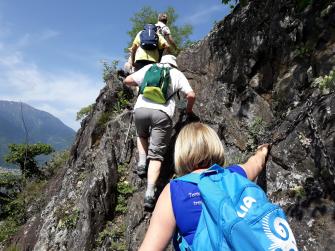
• Active & Green
    • Cycle Tourism
    • Sport

Cycling from Tresenda to Prato Valentino

Highest point 1685 m
Total elevation gain 1310 m
Total elevation loss 1310 m
Total climb 16,5 km
Total descent 12 km
Total distance 28,5 km
Duration 3 - 4 h
Cycling rate (%) 100%

The ascent to Prato Valentino is the same paved road as track n°  33,  starting  from  Tresenda  rather  than  San  Giacomo.  you  can avoid some traffic congested road taking alternative roads that go up from Castelvetro to Vangione and then from Frigeri to the road that leads to San Rocco.Going  right  afterwards  you  meet  the  ascent  from  Teglio  to  Prato. This paved road, especially in the last part, is very hard. From  Prato  Valentino  starts  the  descent.  This  can  also  be  an  option  for  whom,  doing  trail  n°  10  from  Col  D’Anzana,  wants  to descend downstream quickly. The descent is really easy, on a  reasonably  steep  gravel  road  to  Teglio.  Afterwards  the  trail  features    gravel  road  sections,  (few)  paved  road  sections  and  cemented  ones    among  the  vineyards  above  Tresenda.  From  Prato to Teglio you can follow the signs reporting n° 391- Piazza S. eufemia. Approximately 1,5 km after you have started the descent – in  order  to  avoid  a  rather  hard  section  of  the  single  trail -  you’d  better  not  turn  left  (crossroad  S.Sole-brigna),  but  carry on till the mountain huts bollone, take for a short section the  ascending  trail  and  after  the  first  hairpin  go  back  on  the  gravel road  on the left. Once in Teglio descend to Sommasassa  passing  Palazzo  besta,  run  along  the  namesake  lake,  pass  the  San  Gottardo  little  church  and  start  the  beautiful  descent  among the vineyards that takes back to Tresenda.


Other links

On the same topic

The Wayfarer's Path in Varenna

From Varenna walk along the The Wayfarer's Path and discover this ancient route connecting Lake Como and Valtellina
  • Active & Green

Fly Fishing in Lombardy

Fly Fishing in Lombardy
  • Active & Green

Where to Go Fishing in Lombardy

Carps, chars, trout. River and lake fish. Some advice on where to go fishing in Lombardy. From Pavia to Como
Where to go fishing in Lombardy, hints and ideas
  • Active & Green

Il Fiore di Borgoratto Mormorolo

A new network of hiking trails in Oltrepò Pavese.
  • Active & Green

Gardens Como

Lake Como is famous for its villas with fantastic gardens: let's discover them together!
Gardens Como, discovering Lombardy
  • Active & Green

The High Route of Valmalenco – 4th stage

Chiareggio (1612 m) - Rif. Longoni (2450 m) - A. Sasso nero (2304 m) - Rif. Lago Palù (1947 m)
Vista sul Lago Palù
  • Active & Green

Family walks to put a spring in your step

The transition from summer to autumn provides the ideal conditions for regenerating family moments along the scenic trails of Lombardy.
passeggiate_in_ Lombardia
  • Active & Green

On the wings of winter

In winter at the Parco del Mincio to spot flocks of migratory birds.
The Vallazza Natural Reserve
  • Active & Green

Boat trips on Lombardy's rivers

The waterways of Lombardy are perfect to discover the unspoilt green heart of the region
Boat trips on Lombardy's rivers - Navigli Milano
  • Active & Green

The 10 most spectacular monumental trees in the province of Brescia

In Lombardy's largest province, very special tree monuments grow in very different environments.
  • Active & Green

The High Route of Valmalenco – 5th stage

Rif. Lago Palu - Bochel del Torno (2208 m) - A. campascio (1844 m) - A. Musella (2021 m) - Rif. Carate (2636 m) - Rif. Marinelli (2813 m)
Vallone dello Scerscen
  • Active & Green

SHADES OF FALL - WINE BIKE TOUR

  • Active & Green

Teglio walk - Verida - Palama - Ravarola - Teglio

Simple walk through the characteristic rural mid-mountain environment, where cultivated fields, meadows, vineyards and orchards alternate. Depending on the season, typical tellin crops of potatoes, barley, rye and buckwheat can be seen.
  • Active & Green

The high route of Valmalenco - presentation

The high route of Valmalenco is a trekking of 8 stage, around 110 km.
  • Active & Green

The High Route of Valmalenco – 1st stage

Torre Santa Maria (frazione Ciappanico) - Alpe Piasci - Rif. Cometti (1720 m) - Arcoglio sup (2123 m) - Cima Bianca (2490 m) - Rif. Bosio (2086 m)
  • Active & Green

Mountains with ancient history: Valle Camonica

Montagne di storia antica: la Valle Camonica
  • Active & Green

Monumental trees in Lombardy

The art of knowing trees in Lombardy
Alberi monumentali in Lombardia
  • Active & Green

Greenway Voghera - Varzi

A green way towards the Appennines
  • Active & Green

Spring in Valcamonica

4 ideas to enjoy the most sparkling season of the year in Val Camonica.
Signs of Spring at a Unesco Site
  • Active & Green

Visconti park

The medieval splendor come alive in today's Pavia.
Visconti Park
  • Active & Green