- Active & Green
- Sport
Ca' branchi walk - Somasassa - Caven - Tresenda
Difficulty: easy
Type: mixed
Walking time: 2 hours and 30 minutes
Suitable for families with children
From the town of Teglio, follow the provincial road toward Tresenda to the hamlet of Ca' Branchi, where you take the road that descends to the left, following the signs for the Somasassa lake. You can leave your car at the parking lot of the sport fishing lake.
You take the dirt road that descends into the valley and, after a few dozen meters, you can admire an ancient and extensive chestnut orchard. After about 500 meters, you can see to your right the bell tower of the church of San Gottardo, while on the Orobic side, you can see the hamlet of Carona and, further to the right, nestled between two slopes, the bell tower of the hamlet of Bondone.
Detour to Caven
At the beginning of the concrete road, you take the path on your right that descends steeply into the valley, winding through terraced vineyards where Valgella wine, a prestigious Valtellina Superiore docg, is produced. It was precisely at these terraced vineyards that the Caven stelae were found, prehistoric artifacts of great value, which can be viewed today in the rooms of Palazzo Besta.
Now begins a downhill stretch, which continues above the hamlet of Tresenda, towards the end of which one can admire to one's left a stump of celtis australis (hackberry tree) set in a jagged rocky portion. Continuing slightly uphill, the area planted with vines gives way to orchards-apple orchards in particular-and ancient terraces of chestnut trees.
After about 1,300 m, the trail reaches a vantage point on the eastern part of the valley, where the settlements of Boalzo, Bianzone, Villa di Tirano, Tirano (overlooked by the mass of Mount Massuccio) and, at the bottom, the Sernio cone can clearly be seen rising in succession.
At a stream, the return route begins. At the junction with the road leading from Balzo to Teglio, continue left, skirting the stream and on the hairpin bend continue on the asphalt road slightly uphill. Tackling the two uphill hairpin bends, a large chestnut forest opens up, an ideal spot for a short shady stop. At the fork that follows, you continue left following the main road and, on your right, you can admire an ancient votive chapel. You then emerge again at the Somasassa plain.
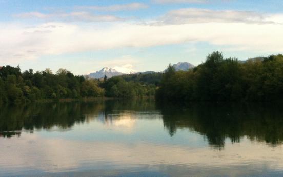
At the fork, you can choose whether to continue to the left and indulge in a visit to the village of Somasassa, or to continue to the right, taking you back to the starting point. After about 20 minutes of walking, you will take the dirt path on the left that skirts Somasassa Lake and leads back to the parking lot.
Click the link below to find out the next route!

