- Art & Culture
- Parks
- Mountains
Walking through time between Grosio and Grosotto
Are you ready for a trip back in time? This is exactly what I did the first time I visited a special place in Valtellina, in the province of Sondrio, in northeastern Lombardy.
First of all, I want to tell you how to get to this magical place: by car from Milan: with the SS 36 direction Lecco and continue to Colico (SS38) direction Sondrio / Tirano / Bormio exit at Grosio and from Brescia with the SS 42 direction Iseo, continue to SS39 Edolo / Aprica / Tresenda (SS 38) / Tirano / Bormio. By train, on the other hand, you will have the Tirano and Sondrio stations, but connections from the stations by bus are not easy and you need to inquire well about schedules, especially if you are traveling on weekends! (STPS Sondrio company https://stps.it, Sondrio ticket office: 0342/213170).
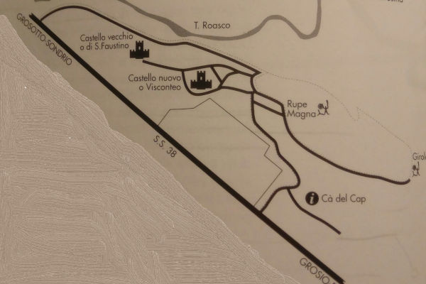
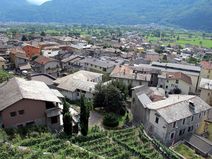
Well, especially if you faced the journey coming from Milan, you will have noticed that the landscape in this area becomes decidedly rugged and alpine, with far fewer habitable and cultivable terraces than in the lower and middle valley. Moreover, you will have spotted the confluence of the main valley and the Grosina Valley, where a rocky outcrop garrisoned by a bell tower and a beautiful castle stands-that's your destination! It is up there, from where there is a wonderful view, that you will make your journey through time... slowly, first exploring the area of the so-called "gemino castle" and then entering the actual archaeological park.
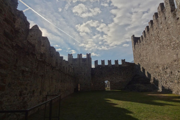
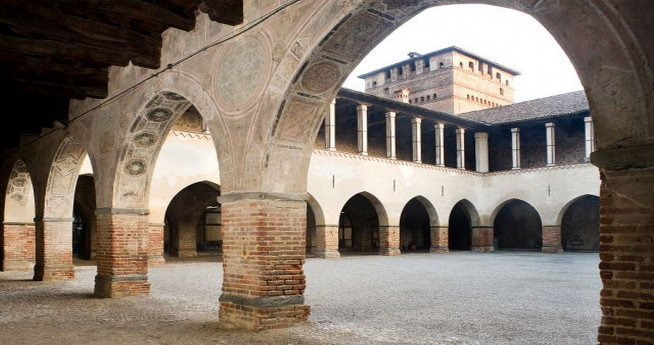
More specifically, we could also recall the names by which this site is identified, in the municipality of Grosotto is the Castle of S. Faustino or old castle (these are mostly ruins of an ancient 10th-11th century fortress, among which the bell tower of the castle chapel dedicated precisely to S. Faustino and Giovita stands out - yes, there's also him! Our Brescian friends know something about it), while in the municipality of Grosio is the "castrum novum," built between 1350 and 1375 at the behest of the Visconti (the lords of Milan).
The new structure was adapted to changing strategic needs, since as early as 1376 it was used as a base by the Visconti troops who, unable to force the Serravalle blockade, encircled the obstacle and, traveling through the Grosina valley, descended on Bormio, conquering the Magnifica Terra. The construction is extraordinary, full of towers and maneuvering spaces, certainly the most articulated castrense structure in the Valley. Although the castle was dismantled in 1526, when the government of the Three Leagues, the new ruler of Valtellina, ordered all military structures to be dismantled, the remains are absolutely impressive and one can still imagine what military life was like in the Middle Ages up there.
Inside the main clearing of the new castle, archaeological excavations have been carried out to understand more about the prehistoric people who already lived on these sunny heights, where they left evidence of their lives and beliefs in more than 5,000 petroglyphs (=carvings on stone) carved into the rock of Rupe Magna, located not far from the castle. The work revealed the presence of a settlement, protected by walls, which can be traced back to the 16th century B.C. and which, changing over time, continued its life until the Iron Age, around the 6th - 5th century B.C.
It is precisely the inhabitants of the Dosso dei Castelli who are the authors of the carving of the Rupe Magna and other erratic boulders in the surrounding area. In fact, the large cliff, due to its shape and position, resembling a large, ancient whale, is home to thousands of engraved signs, which project us directly back in time.
In 1966, Prof. Davide Pace accidentally found a series of cupped rocks (= with small hollows made in them) on Dosso Giroldo, and between 1970 and 1971, he unearthed some anthropomorphic figures on the Rupe. The Rupe is a large mounded rock formed from micacrysts smoothed by Wurmian glaciers, shaped over 20,000 years ago by the action of ice flowing over it, dragging a large amount of debris with it.
With the discovery of the archaeological site and the treatment of cleaning, restoration, surveying and cataloguing both on the cliff and in the surrounding area, the recognition of more than 20,000 engraved figures has been achieved, making the site the third largest alpine area in terms of number and density of depictions, after Valcamonica (BS) and Mount Bego (France).
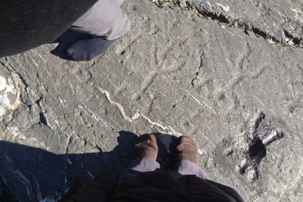
Most of the rock carvings were made with the technique known as "a martellina," obtained by tapping the rock surface with a stone tool, which creates small circular concavities. Another technique adopted is the "filiform" or "graffito" technique: in this case, the depictions are obtained by etching the rock surface with a pointed tool.
In attempting to delineate a chronological dating of the rock engravings, the extensive Camunian figurative repertoire with which the Grosine one has been compared has been taken into account, because the two areas share common themes and styles. At present, scholars have identified four historiative phases from the prehistoric period: the first period corresponds to the 4th-3rd millennia B.C. (Neolithic and Copper Age), the 2nd and 3rd periods are to be referred to the 2nd millennium (Bronze Age), and the 4th period is to be attributed to the Iron Age. Medieval engravings, although present, are rather rare.
As for the themes, which allow us to imagine some aspects of life in the past, we can find figures of spirals, collariform and topographical representations in the earliest period; on the other hand, the human figure appears in the intermediate phase, with characteristic U-shaped arched limbs or depicted as praying (= man praying).
A mysterious serpentiform double image, reaching 20 m in length, is with certainty the longest figure in Alpine rock art and one of the longest in the world. Many of the figures depicted are armed with shields and short swords or staffs, with which they seem to face each other in a kind of duel. Finally, in the third phase, very schematic figures of warriors appear, where oval-shaped spears and shields, sometimes cowled helmets, are recognized as weapons. Few zoomorphic (=animal) figures appear next to the warriors, although a few horsemen with even a "banner" stand out. Fertility-related signs accompany them.
The visit winds over the body of the cliff itself, where you enter barefoot so as not to ruin the petroglyphs, and slowly your eyes get used to distinguishing the figures engraved in the rock (the park operator-accompaniment is compulsory-helps you read by wetting the rock surfaces and pointing to the different images) so you can distinguish the details.
It is possible to complete the visit to the Ca' del Cap, the site of the antiquarium attached to the archaeological park where, in addition to artifacts from the excavation, a number of sporadic ( = fortuitously found outside the excavation) but nonetheless significant artifacts are on display to allow one to place the people who inhabited this area in cultural contact first and foremost with the nearby Valcamonica area, but also with the culture prevalent in the Trentino Alto Adige area and the adjacent Helvetic area.
In addition to the cultural-historical trail , it is also possible to follow the "educational nature trail" that allows the visit to be supplemented with ecological, geological and naturalistic insights. Some points allow you to recognize the characteristics of the chestnut forest and thermophilic forest, with indications of the many animal and plant species in the area.
Text edited by SARA NUZZI, ConfGuide-GITEC certified guide.
If you enjoyed this story, CLICK HERE to discover its various itinerary suggestions.
