- Mountains
- Art & Culture
- Active & Green
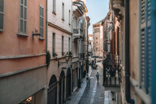
The cavallera road of the Muretto
An ancient alpine connecting corridor, a transit route for goods, people and culture
Due to its special geographic location, the Valmalenco has since the earliest centuries been a natural alpine connection corridor strategically relevant from various points of view: political, economic and religious. The credit for the key role assumed by the Valmalenco is mainly due to the Muretto Cavallera Road.
To understand the importance of this communication route, it is necessary to start from its ancient origins, which have their roots in the time of the Roman Empire, but which bring to light issues as relevant as ever: the system of relationships established between those who live in the territory and those who cross it, and the exchange of products, cultures, ideas and ideals that ensues.
THE ORIGINS.
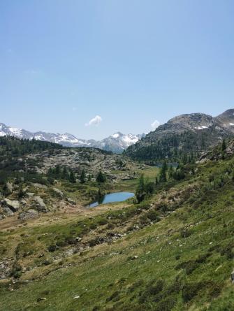
The ancient Muretto route started from Sondrio climbing all along the Valmalenco with an elevation gain of about 2200 m, reached the pass of the same name at an altitude of 2562 m, and then descended again through the Swiss Muretto valley to the Maloja pass. The central location of this road and the relative ease of its route made it particularly popular even during the Middle Ages. The ancient medieval road must have almost entirely traced a pre-existing road, probably of Roman origin, as can be deduced from the discovery of some archaeological finds from Roman times in the territory of Chiesa and along the via cavallera (a silver needle, a sword hilt, an iron chain, two terracotta oil lamps and some bronze and silver coins).Such finds suggest that the Valmalenco and the Muretto route were used as an area of troop passage and a settlement area for military appropriations.
The name Muretto is relatively recent: until the entire sixteenth century the pass was called Monte dell'Ord or l'Oro-anciently the voice Monte meant a mountain to be crossed, while the toponym Oro is also found on the Swiss side of the Muretto valley, which is also called the Ordlegna valley, or or d'legna, which in the Engadine dialect means gold of Egna, of the Engadine.
The origin of the present name is also uncertain, but the most reliable hypothesis is that of historian Enrico Besta, who has the voice Muretto derived from the Val Bregaglia's Murum, meaning the natural wall that divides the valley into Sopra and Sottoporta. Also on the Muretto Pass a natural rock wall divides the two adjacent valleys, Italian and Swiss.
STRATEGIC IMPORTANCE
During the Middle Ages , the Muretto route was at the center of local history, frequently traveled because it represented the fastest and most direct route for those coming from the land of Bergamo and the Republic of Venice to continue on to Switzerland, in the direction of Chur and the German territories.
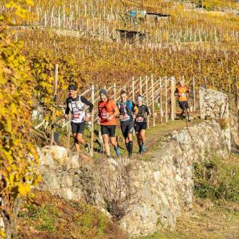
It was frequent transit for caravans of Graubünden merchants, who reached the Valmalenco to purchase piode, laveggi and livestock, but also to procure the prized Valtellina wine and other products from Italy, such as salt, spices, grains and cotton. The transit of the Malenchi along the Muretto route was quite frequent, especially because of seasonal movements with livestock: the mountaineering of the Malenche and lower valley populations (from Montagna, Tresivio, or even from Bergamo territory), often went beyond the Muretto border, to the alpine pastures of Plancanin and Cavloc, adjacent to the border.
Along withlivestock and dairy production, the mining industry of quarrying and processing slate and soapstone already constituted the centerpiece of the Malenca economy at the time and had fostered the development of a significant export business to lands beyond the Alps. The emigration of Malenks crossing the border in search of work further strengthened human and cultural contacts, evidenced by the fact that numerous marriages between Malenks or Valtellinesi and Bregagliotti or Engadinese were already being celebrated during the Middle Ages.
Those who set out along the via cavallera, however, were not only motivated by economic reasons, but also by spiritual ones: as recorded in an ancient register of the parish of Lanzada, "by ancient custom a procession of all the parishes of the valley was made to S. Gaudenzio di Casaccia beyond the mountain of Cereccio or dell'Ord."
Theeconomic and political importance of Valmalenco developed during the 11th and 12th centuries, when the Capitanei, a family of Lombard lineage originally from Vizzola, had become lords of Sondrio and extended their jurisdiction over Valmalenco as well. The Capitanei conducted a policy of matrimonial alliances with the feudal families of Val Bregagia and Engadine, succeeding in welding their own Guelph front with the transalpine one and thus assuming a decisive political position. It is assumed that they had built a system of fortified buildings and signal towers along the Muretto road, which allowed an effective network of light signals with Masegra Castle.
Since the conquest of the Valtellina in 1512, the Three Leagues government exploited the great possibilities offered by this land, both economically and commercially, and politically, militarily and diplomatically. The Valmalenco, in its position as a direct linking corridor, constituted in those years a strategic region also from a religious and social point of view: in fact, the Protestant Reformation spread here as well, through the establishment of some evangelical communities that were numerically substantial, such as that of Mossini at the mouth of the Valley, and politically and economically influential, such as those of Chiesa and Lanzada. Indeed, the road through the Valmalenco was one of the fastest and most direct routes of communication between Graubünden and the Republic of Venice, from which many exiles religionis causa came.
THE DECLINE.
Commercial transit on the Via Cavallera remained flourishing until the seventeenth century, but it began to show the first signs of decline as early as the second half of the eighteenth century, probably in connection with the increased volume of traffic on other, easier Rhaetian routes such as the Bernina and Spluga. The decline turned to collapse beginning in 1797, when the Grisons government was replaced by Napoleonic rule, followed by Austrian rule.
THE RECOVERY.
Abandoned to itself, the Muretto route was reduced to little more than a path, beaten mainly by smugglers and Malencian shepherds who went to seek work in the Engadine, and by those early tourists, mountain lovers, who between the nineteenth and twentieth centuries were discovering the beauty of the Alpine valleys.
Today, thanks in part to projects such as B-ICE & Heritage, the enhancement of the Cavallera road allows us to travel this ancient route with the knowledge that it will not only lead us to the discovery of breathtaking landscapes, but also to a history that is as ancient as it is modern, made up of economic, political and cultural entanglements.
Opening hours
The City of Chiesa is also promoting a study and enhancement of the Muretto Road, now the Rusca Trail, through historical research and the establishment of an educational thematic trail for children, families and school groups, from Chiesa to the Muretto Pass.