I found 453 results for Borghi

Pizzighettone

One of the most interesting walled cities of the Lombardy region, divided by the Adda river.
PIZZIGHETTONE_VEDUTA AEREA_LIB_COMUNE_PIZZIGHETTONE

The walls of Pizzighettone

Pizzighettone is an extremely interesting village with very peculiar characteristics. Thanks to its natural position it seems similar to a town, crossed by a big river a defended by its walls. Till some years ago the walls were entirely covered by the grass but then, thanks to the involvement of an Association called Gruppo Volontari Mura ,the walls were restored. Now it is possible to visit them.The guided tour generally starts from the external ditch. The area, which in the past was occupied by the Serio Morto’s water, is nowadays a nice garden where you can go for a walk or participate to some shows or concerts. The walls of Pizzighettone are particularly interesting because, inside of them, it is possible to organize some events and exhibitions.

Angera

An ancient town in the province of Varese on the Lombard shore of Lake Maggiore.
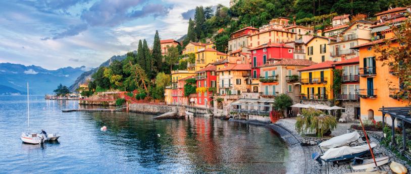
Lakeside promenade of Angera, with a small beach. By the lake, there is an empty sun lounger, and you can see the Rocca in the distance.

Romagnese

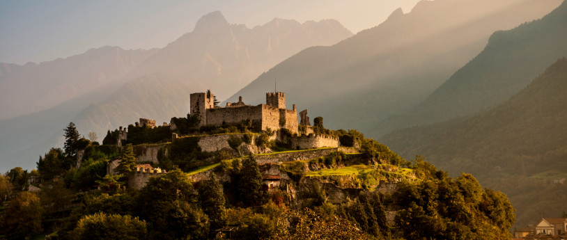
Romagnese is a characteristic medieval town. The Dal Verme family ruled the area and built its fourteenth century castle. Of its ancient splendour two buildings which were once part of the castle have survived to the modern day - a tower and a sandstone building with a beautiful nineteenth century portal.
Romagnese

Castles and fortifications around Lake Como

Several testimonies of a past rich in history, all to discover
@primalavaltellina.it

History of Lodi

@www.comune.lodi.it

Palazzo del Podestà

In the shadow of the Campanone di Bergamo, in Piazza Vecchia, Palazzo del Podestà tells the story of distant origins: the story of the Sixteenth century!
Al suo interno il Museo storico del Cinquecento

Rocca of Bergamo

The castle has long been a landmark and the protagonist of events that have changed the city’s history.
Rocca di Bergamo

Valle Lomellina

Valle Lomellina is a populous town in central Lomellina, rich in agricultural and industrial activities. Many industries in the town are involved in rice refining; there are small artisanal workshops that mill rice as was done in the past, as well as large food industries that distribute Lomellina's rice throughout Europe. At the heart of the town, with its typical layout of low houses along wide, irregular streets, stands a curious 14th-century castle, altered in the 19th century with romantic additions. Due to its unique semicircular shape, central structure with cylindrical towers, arcaded loggias with pointed arches, and its rich collection of battlements and beccatelli, the castle is an architectural complex that is decidedly unusual and worthy of being imagined as the setting for a Walter Scott adventure novel. The adjacent neighborhood is also interesting, having preserved the typical features of a medieval village. In addition to the 17th-century parish church, the small church of Santa Maria del Castello is definitely worth a visit, where 15th-century frescoes were recently discovered, as well as the 16th-century Sanctuary of the Madonna di Casaletto, located just outside the town center along the road to Lomello. Every Sunday, Valle hosts a lively and colorful market, unique in Lomellina on the holiday. SOURCE: MUNICIPALITY OF VALLE LOMELLINA

Nicorvo

Located between Vercelli and Mortara, Nicorvo is a small village immersed in the tranquility of the rice fields. Since 2006, a small group of volunteers has been taking care of pilgrims walking the Via Francigena who request hospitality. The parish church is dedicated to San Terenziano, the patron saint of the village. Consecrated in 1620, it has five altars, and several fine paintings can be seen, with the best being the one in the choir, which depicts the Blessed Virgin of the Rosary with the Child Jesus and Saints Dominic and Terenziano, Bishop. The painting is attributed to the Lanino school, which is thought to have worked in the area during the time the church was built. Another church very dear to the people of Nicorvo is the one they call the "Madonnina," dedicated to the Madonna del Patrocinio. Built in 1764, it assumed its current form in 1910 after several restorations. In the Parish House in the center of the village, 8 beds with mattresses are available (additional cots or mattresses can be added if needed). In the large hallway adjacent to the Parish House, bicycles can be parked sheltered from rain and indoors. For more information, you can write to: HOSPITALITY MADONNA DEL PATROCINIO AND SAN TERENZIANO email: ospitale.francigena.nicorvo@gmail.com facebook: Nicorvo Via Francigena @nicorvo.viafrancigena instagram: nicorvo.viafrancigena telegram: Ospitale Nicorvo tel. +39 371 5174578   Photo Di Alessandro Vecchi - Opera propria, CC BY-SA 3.0, https://commons.wikimedia.org/w/index.php?curid=10745415
Di Alessandro Vecchi

Tromello

Along the right bank of the Terdoppio stream, on the road connecting Pavia to Mortara, is the first stop of the Via Francigena.
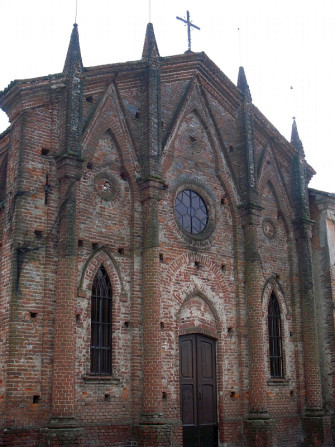
Parrocchiale di San Martino

Travacò Siccomario

The municipality of Travacò Siccomario is located two kilometers south of Pavia, between the Ticino and the Po rivers, at their confluence. Together with the municipality of San Martino Siccomario, it is part of the territory called Siccomario. The Siccomario: Name and Territory in the Oldest Documents To address the issue of the origin of the rather unusual name of Travacò Siccomario, it is necessary to examine the two terms "Travacò" and "Siccomario" separately, based on the objective data derived from available archival documentation. From this, it is clear, as will be shown, that the imaginative interpretations suggesting that "Siccomario" comes from "sicut mare" or "siccum maris," as proposed by some chroniclers, are completely fanciful and unfounded. The same applies to those claiming the name derives from a category of swamp reclamation workers called "sighemarii." However, before delving into this, it is essential to clearly define the territorial extent of Siccomario. Geographical Delimitation of Siccomario The toponym "Siccomario," or more precisely the coronym (since it refers to a territory rather than individual towns or settlements), identifies a well-defined area. In 1330, the chronicler Opicino de Canistris describes the territory south of Pavia as follows: "The central part of the territory south of the city is bordered by three rivers. The Po at 5 miles, the Gravellone at 500 meters, and the Ticino along the city's walls themselves. The smallest part of the territory in this direction lies between the Ticino and the Gravellone, all belonging to the Municipality [of Pavia], and contains only meadows and the site of justice." This is the current Borgo Ticino. "The second part is full of excellent fields and produces abundant fruits of various kinds." This part, between the Gravellone and the Po, is called Siccomario ("Siccomarium appellatur"). Here, wines are produced that are not harmful in summer due to their low alcohol content, which, while not of high quality, still have their merits. Near the city, within Siccomario, there is a place commonly known as Terra Arsa, located one and a half miles from the city walls, where St. Martin of Tours was raised. There is another part beyond the Po, which is the true Oltrepò. Further details show that Opicino adds: "This city is surrounded, especially in Siccomario, by many gardens and orchards, and many pomarii," referring to orchards where apples are cultivated. From this description, it seems that Siccomario was the land between the Gravellone and the Po, with a part of it, where St. Martin's settlement was located during Opicino's time, being called "Terra Arsa." This fact is corroborated by medieval documents, where references to San Martino always say "San Martino in Terra Arsa," never "in Siccomario." Thus, the expansion of the term Siccomario to San Martino is certainly a more recent development. The Term "Siccomario" in the Oldest Documents The oldest document referring to the current Siccomario area is a donation made by Charlemagne to the great Monastery of St. Martin of Tours in 774, after he besieged Pavia and defeated the Lombards. In this document, although it deals with churches and lands located in Siccomario, the term "Siccomario" does not appear. At this time, and for several centuries afterward, the name "Siccomario" continues to be absent. However, the adjective "arida" is used, but not "terra arsa," which first appears in 909, in a document by Berengar I, which mentions "pratellos quinque" [five meadows] in a place called terra arsa, a meadow with a small grove. So, during this period, the name "terra arsa" is used, but the toponym Siccomario does not yet exist. After almost two centuries with no relevant documentation, in a document from October 2, 1099, we finally see the first mention of "Siccomario." The Abbey of St. Maiolo in Pavia, in fact, sells goods "in loco et fundo Sigemario at Pozzallo" ("Locus et fundus" is a term used to describe a small rural settlement, typically a village with its surrounding land). In any case, the most logical explanation is that "Sigemarius" is a Germanic personal name, well attested in Lombardy as early as the 8th and 9th centuries, probably of Frankish origin, although this cannot be stated with absolute certainty. Who this Sigemario was, why he had property in this area, and why his name was left behind is unclear. However, an interesting coincidence reinforces this interpretation: there was a Monastery in Pavia in the 9th century called "de Sigemario." This fact is enough to attest to the existence and circulation of this name. The Monastery "de Sigemario" was named as such because it was founded by someone named Sigemario. However, the exact location of this Monastery is not known, and by the 10th century, it disappears from the records. Thus, the most logical explanation is that "Siccomario" derives from a personal name that eventually became a toponym. The traditional explanation was that it came from "secco mare" (dry sea) until Olivieri, around 1930, proposed the interpretation linked to the name "Sigemarius." Olivieri was a prominent toponymist who wrote a dictionary of Lombard toponymy, and all subsequent scholars have adopted his interpretation. Thus, the name Siccomario, in the form "Sigemario," very similar to a personal name, first appeared in the 11th century, in 1099, and became firmly established from that time on. Other Important Documentary Evidence From this time onward, particularly starting in 1120, we have numerous documents related to the goods that the Abbey of St. Maiolo owned in this area, especially lands, which were granted, sold, and expanded through new purchases. Therefore, the history of this area is increasingly well documented. Let's look at them quickly. The first document after 1099 is dated 1120 and mentions a "clausura super fluvium Ticinum" (the "clausura" was a fenced-in area, usually a vineyard). "Super fluvium Ticinum" means "beyond the Ticino river." The document goes on to say "in loco et fundo Casellae qui dicitur in Sigemario prope Pozzolum." There is a whole series of documents that mention the Ticino and "loco et fundo Sighemario" with various specific places located within the Siccomario territory. Furthermore, in 1130, there is mention of lands "in Sigemario" being donated to the Church of St. Mary of Bethlehem. At one point, in 1171, a vineyard plot appears in "Sigemario vetulo," meaning the old Siccomario. This indicates the need to distinguish the old Siccomario from a new territory, which likely had not been previously named this way but was now recognized as part of the Siccomario. For the entire 12th century, we see a series of place names until 1180, when a new and interesting element of the landscape appears: "in loco et fundo Sigemario prope Ruptam." This is the first mention of the name "Rupta," which had never been attested before. In this regard, the testimony of the Anonymous of the 800s is interesting, as he states that the Rotta divides the Siccomario in half, with "terra arsa" (the territory of San Martino) on the left and the true Siccomario on the right. The Rotta thus separated Siccomario from "terra arsa." There is also a papal bull from 1187 for the Monastery of St. Agatha of Pavia, listing many properties scattered throughout Northern Italy. At one point, it mentions "prata omnia super Ticinum," meaning "all the meadows beyond the Ticino," but without specifying the location. Soon after, the same bull mentions "ad Sanctum Martinum in terra arsa campum unum," but still does not mention Siccomario. This document, although from 1187, likely copies an older document, possibly from before the 11th century, because it would have been impossible at this time to not mention Siccomario when discussing lands between the Ticino and the Po rivers. Still, in the same document, we find "Sigemario vetulo" (old Siccomario) and later "S. Maria di Siccomario," which, in 1187, is under the jurisdiction of the Monastery of St. Maiolo. Regarding the Term "Travacò" Regarding the term "Travacò," we can refer to Olivieri's "Dictionary of Lombard Toponymy" and the numerous commentators and scholars who reference it, indicating "travacca" as a structure used to reinforce a riverbank, which is particularly suitable given the nature of the area. The "travacca" would thus be an element used to reinforce a riverbank. In Lombardy, this is a common name, and there are farms named "Travacca," "Travaccò," etc. The accent on the final "o" is typical of other names that originally ended in "atum." Therefore, the name likely originated as "trabaccatum," meaning a place where a "trabacca" (reinforcement element) was built along a watercourse. Fonte: Comune di Travacò Siccomario