I found 162 results for Nei borghi dell’Oltrepò

Golferenzo

Piccolo gioiello della Valle Versa, meta imperdibile per chi compie un viaggio nell'Oltrepò Pavese

Zenevredo

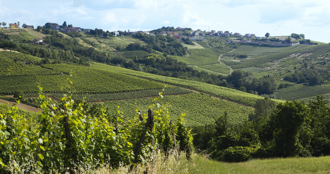
The municipality of Zenevredo is located in the hills of the Oltrepò Pavese, not far from the plains, on the right bank of the Versa stream. The village of Zenevredo is characterized by a predominantly hilly landscape, typical of the Lower Po Valley. The toponym, as Cenevretum, first appears in the list of lands of the Pavia countryside from 1250, as part of the Oltrepò. Zenevredo appears in the list of declarations of the hearth tax in the Principality of Pavia for the year 1537, as part of the rural Congregation of Oltrepò and Siccomario. The prefect of the Marengo department, according to the law of the 28th day of the rainy year VIII (February 1800), appoints the mayors and their assistants of the municipality of Zenevredo with a decree of 23 Fruttidoro year IX (September 1801). Zenevredo is included in the Marengo department and the Voghera district (Campana decree 1801). In the first pratile year X (May 1802), the prefect of the Marengo department decrees the appointment of 10 municipal councilors, who are to remain in office for three years (Campana decree 1802). In 1805, due to the restructuring of the Ligurian-Piedmontese administration desired by Napoleon Bonaparte, Zenevredo, by decree of June 13, 1805, was merged into the department of Genoa, Voghera district (decree 1805, ASC Casei Gerola). In 1859, with a population of 372 inhabitants, Zenevredo became part of the province of Pavia and was included in the IX district of Montù Beccaria, Voghera district (decree 1859). Upon the formation of the Kingdom of Italy in 1861, the municipality had a resident population of 385 inhabitants (Census 1861). According to the 1865 municipal organization law, the municipality was governed by a mayor, a council, and a board. Following the reform of the municipal organization in 1946, the municipality of Zenevredo continued to be governed by a mayor, a council, and a board. Source: https://www.visitoltrepo.com

Montesegale

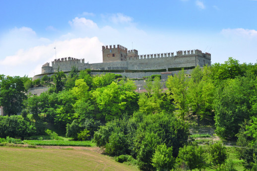
A small, authentic village in the province of Pavia, dominated by a castle and with a passion for art and archery.
Castello di Montesegale

Wine and Flavor Trail Valtellina

A scenic road through the terraced vineyards
Strada vino e sapori Valtellina, percorriamola insieme

Good Wine

Oltrepò Pavese, a Land of Wine and Riches

Boroughs Pavia

Art, food & wine, relax. Boroughs surrounding Pavia are a fantastic destination for the weekend

Towns and Villages near Lake Iseo

The villages and towns on Lake Iseo are jewels of narrow streets and shops, between history and naturalism.

Corteolona

In Corteolona King Liutprand (712-744) had a magnificent residence built and decorated with marbles, columns and precious mosaics which he brought in specially from Rome. The palace was located on the site of the current Castellaro farmhouse. Even after the fall of the Lombard kingdom the Carolingian kings and the Regnum Italiae continued to use Corteolona palace.

Travacò Siccomario

The municipality of Travacò Siccomario is located two kilometers south of Pavia, between the Ticino and the Po rivers, at their confluence. Together with the municipality of San Martino Siccomario, it is part of the territory called Siccomario. The Siccomario: Name and Territory in the Oldest Documents To address the issue of the origin of the rather unusual name of Travacò Siccomario, it is necessary to examine the two terms "Travacò" and "Siccomario" separately, based on the objective data derived from available archival documentation. From this, it is clear, as will be shown, that the imaginative interpretations suggesting that "Siccomario" comes from "sicut mare" or "siccum maris," as proposed by some chroniclers, are completely fanciful and unfounded. The same applies to those claiming the name derives from a category of swamp reclamation workers called "sighemarii." However, before delving into this, it is essential to clearly define the territorial extent of Siccomario. Geographical Delimitation of Siccomario The toponym "Siccomario," or more precisely the coronym (since it refers to a territory rather than individual towns or settlements), identifies a well-defined area. In 1330, the chronicler Opicino de Canistris describes the territory south of Pavia as follows: "The central part of the territory south of the city is bordered by three rivers. The Po at 5 miles, the Gravellone at 500 meters, and the Ticino along the city's walls themselves. The smallest part of the territory in this direction lies between the Ticino and the Gravellone, all belonging to the Municipality [of Pavia], and contains only meadows and the site of justice." This is the current Borgo Ticino. "The second part is full of excellent fields and produces abundant fruits of various kinds." This part, between the Gravellone and the Po, is called Siccomario ("Siccomarium appellatur"). Here, wines are produced that are not harmful in summer due to their low alcohol content, which, while not of high quality, still have their merits. Near the city, within Siccomario, there is a place commonly known as Terra Arsa, located one and a half miles from the city walls, where St. Martin of Tours was raised. There is another part beyond the Po, which is the true Oltrepò. Further details show that Opicino adds: "This city is surrounded, especially in Siccomario, by many gardens and orchards, and many pomarii," referring to orchards where apples are cultivated. From this description, it seems that Siccomario was the land between the Gravellone and the Po, with a part of it, where St. Martin's settlement was located during Opicino's time, being called "Terra Arsa." This fact is corroborated by medieval documents, where references to San Martino always say "San Martino in Terra Arsa," never "in Siccomario." Thus, the expansion of the term Siccomario to San Martino is certainly a more recent development. The Term "Siccomario" in the Oldest Documents The oldest document referring to the current Siccomario area is a donation made by Charlemagne to the great Monastery of St. Martin of Tours in 774, after he besieged Pavia and defeated the Lombards. In this document, although it deals with churches and lands located in Siccomario, the term "Siccomario" does not appear. At this time, and for several centuries afterward, the name "Siccomario" continues to be absent. However, the adjective "arida" is used, but not "terra arsa," which first appears in 909, in a document by Berengar I, which mentions "pratellos quinque" [five meadows] in a place called terra arsa, a meadow with a small grove. So, during this period, the name "terra arsa" is used, but the toponym Siccomario does not yet exist. After almost two centuries with no relevant documentation, in a document from October 2, 1099, we finally see the first mention of "Siccomario." The Abbey of St. Maiolo in Pavia, in fact, sells goods "in loco et fundo Sigemario at Pozzallo" ("Locus et fundus" is a term used to describe a small rural settlement, typically a village with its surrounding land). In any case, the most logical explanation is that "Sigemarius" is a Germanic personal name, well attested in Lombardy as early as the 8th and 9th centuries, probably of Frankish origin, although this cannot be stated with absolute certainty. Who this Sigemario was, why he had property in this area, and why his name was left behind is unclear. However, an interesting coincidence reinforces this interpretation: there was a Monastery in Pavia in the 9th century called "de Sigemario." This fact is enough to attest to the existence and circulation of this name. The Monastery "de Sigemario" was named as such because it was founded by someone named Sigemario. However, the exact location of this Monastery is not known, and by the 10th century, it disappears from the records. Thus, the most logical explanation is that "Siccomario" derives from a personal name that eventually became a toponym. The traditional explanation was that it came from "secco mare" (dry sea) until Olivieri, around 1930, proposed the interpretation linked to the name "Sigemarius." Olivieri was a prominent toponymist who wrote a dictionary of Lombard toponymy, and all subsequent scholars have adopted his interpretation. Thus, the name Siccomario, in the form "Sigemario," very similar to a personal name, first appeared in the 11th century, in 1099, and became firmly established from that time on. Other Important Documentary Evidence From this time onward, particularly starting in 1120, we have numerous documents related to the goods that the Abbey of St. Maiolo owned in this area, especially lands, which were granted, sold, and expanded through new purchases. Therefore, the history of this area is increasingly well documented. Let's look at them quickly. The first document after 1099 is dated 1120 and mentions a "clausura super fluvium Ticinum" (the "clausura" was a fenced-in area, usually a vineyard). "Super fluvium Ticinum" means "beyond the Ticino river." The document goes on to say "in loco et fundo Casellae qui dicitur in Sigemario prope Pozzolum." There is a whole series of documents that mention the Ticino and "loco et fundo Sighemario" with various specific places located within the Siccomario territory. Furthermore, in 1130, there is mention of lands "in Sigemario" being donated to the Church of St. Mary of Bethlehem. At one point, in 1171, a vineyard plot appears in "Sigemario vetulo," meaning the old Siccomario. This indicates the need to distinguish the old Siccomario from a new territory, which likely had not been previously named this way but was now recognized as part of the Siccomario. For the entire 12th century, we see a series of place names until 1180, when a new and interesting element of the landscape appears: "in loco et fundo Sigemario prope Ruptam." This is the first mention of the name "Rupta," which had never been attested before. In this regard, the testimony of the Anonymous of the 800s is interesting, as he states that the Rotta divides the Siccomario in half, with "terra arsa" (the territory of San Martino) on the left and the true Siccomario on the right. The Rotta thus separated Siccomario from "terra arsa." There is also a papal bull from 1187 for the Monastery of St. Agatha of Pavia, listing many properties scattered throughout Northern Italy. At one point, it mentions "prata omnia super Ticinum," meaning "all the meadows beyond the Ticino," but without specifying the location. Soon after, the same bull mentions "ad Sanctum Martinum in terra arsa campum unum," but still does not mention Siccomario. This document, although from 1187, likely copies an older document, possibly from before the 11th century, because it would have been impossible at this time to not mention Siccomario when discussing lands between the Ticino and the Po rivers. Still, in the same document, we find "Sigemario vetulo" (old Siccomario) and later "S. Maria di Siccomario," which, in 1187, is under the jurisdiction of the Monastery of St. Maiolo. Regarding the Term "Travacò" Regarding the term "Travacò," we can refer to Olivieri's "Dictionary of Lombard Toponymy" and the numerous commentators and scholars who reference it, indicating "travacca" as a structure used to reinforce a riverbank, which is particularly suitable given the nature of the area. The "travacca" would thus be an element used to reinforce a riverbank. In Lombardy, this is a common name, and there are farms named "Travacca," "Travaccò," etc. The accent on the final "o" is typical of other names that originally ended in "atum." Therefore, the name likely originated as "trabaccatum," meaning a place where a "trabacca" (reinforcement element) was built along a watercourse. Fonte: Comune di Travacò Siccomario

Redavalle

The current Redavalle is the heir of an older settlement, San Martino in Strada. In the area, there existed a Roman settlement mentioned in ancient itineraries as Cameliomagus or Comillomagus (forms resulting from the careless writing of a probable Camillomagus). The itinerary distances would suggest Broni as the location, but it is certain that numerous Roman artifacts have been found in Redavalle, which proves the Roman origin of San Martino in Strada, whether it corresponds to Camillomagus or not. Like many ancient centers that survived the barbarian invasions, it had its own parish, dependent on the diocese of Piacenza, whose name (San Martino in Strada) replaced the ancient name of the location. San Martino came under Pavia's dominion in 1164, when it was probably a dependency of Broni; it was, however, equipped with a castle, which was burned by the forces of the Lombard confederates during the wars against Frederick I Barbarossa. San Martino in Strada, located slightly to the east of Redavalle, never recovered from the disaster. It was then that Redavalle (so named in 1250), situated on the western edge of the San Martino municipality, began to grow in importance, eventually absorbing the entire population of the old center. Around 1560, the San Martino parish was abandoned, and the archpriest settled at the chapel of San Rocco in Redavalle (which took the name of San Rocco and San Martino). Redavalle was part of the Broni fief, which from the 13th century belonged to the Beccaria family and, from 1536 until the end of feudalism (1797), to the Arrigoni family of Milan. As mentioned, Redavalle stood near the western boundary of the municipality, so much so that part of the town extended into the adjacent municipality of Santa Giuletta; this anomaly was resolved in 1866 with the transfer of a section of Santa Giuletta’s territory to Redavalle (called the Rile fraction). Redavalle: a small village at the foot of the hills of Oltrepò Pavese, just a couple of minutes by car along the Via Emilia, but a place like any other only on road maps. This spot, halfway between the cities of Casteggio and Broni, now houses a population of just over 1,000 souls: it once represented the most important center on the route between Iria (Voghera) and Placentia (Piacenza). Its origins date back to the pre-Roman period; its founders and first inhabitants were the Ligurian and Celtic populations who contested dominion over the territory before the Roman conquest at the end of the 3rd century BC: Cameliomagus was its name, as reported on the Tabula Peuntiger, a kind of road map depicting Roman itineraries, major centers, and post stations. Among these, at 17 Roman miles from Iria and 25 from Placentia, the settlement of Cameliomagus is listed, stretching its boundaries up to the present-day villages of Manzo (Santa Giuletta) and Ca' del Piano (Cigognola). The center is to be located at the foot of the hills, in the territory of Redavalle and Cassino Po, scattered with inns, stables for changing horses, taverns, shops, and patrician villas, of which unfortunately no large remains remain: some inscriptions, many coins, urns, lamps, and funeral furnishings, mostly found in the Gragnolate necropolis, the Vacca d'oro and Bruciati estates, and during 19th-century excavations at the demolished Bornaghi kiln. Present in several lower hill areas of Redavalle, along which the Postumia road ran, are fragments, tiles, bricks, and other evidence of the Roman presence, which was constant and prosperous until the decline of the Empire. Due to its strategic position, ancient Cameliomagus suffered, starting at the end of the 4th century AD, a progressive impoverishment due to the barbarian invasions and the economic and political instability of those centuries. The slow Christianization of the first millennium brought significant historical, religious, and architectural changes to ancient Redavalle, but only a few remains are left, the first of which is the ruined pillar at the entrance to the town coming from Broni, near the junction with the road leading to Pietra de' Giorgi. This pillar, commissioned by Archpriest Primo Andrea Sterpi in 1724, was erected to commemorate the Pieve of San Martino in Strada, probably built in the 9th-10th century AD, which for several centuries gathered in its divine worship the parishes and populations of neighboring towns, including Cigognola, Pietra de' Giorgi, Barbianello, Mornico Losana, and Santa Giuletta. It was an important Pieve, with structures to accommodate travelers and pilgrims on the Roman Way, whose power, however, was weakened over the centuries by plagues and the neglect of its rulers, leading to the abandonment and decay of the church, replaced for services by a chapel in the town center dedicated to San Rocco, later expanded in the early 18th century by architect Veneroni into the current structure, masterfully restored in the last decade of the last century. The rule of the Franks, followed by the local feudal dominations and the power of the individual municipalities, marked a dark period in Redavalle’s history: it is unfortunately remembered for the burning of the town's castle in 1164 by the people of Piacenza and Cremona, fighting against the city of Pavia, allied with Frederick Barbarossa, an event engraved in popular tradition and depicted on the town’s coat of arms. In the following centuries, after the Renaissance dominations of the Visconti-Sforza, came that of the Spanish and, from 1713, the Austrians. The village, which gradually formed around the aforementioned chapel, was embellished in the 17th century by the construction of two chapels at the entrance to the town, now restored and dedicated to the Madonna and the memory of the Fallen. In 1743, with the Treaty of Worms, the territory of Redavalle, along with all of Oltrepò Pavese, passed under Savoy rule, later becoming part of the province of Pavia in 1861. Source: Comune di Redavalle PHOTO:  Portale www.visitoltrepo.com

Mortara

Mortara has earned the title of the homeland of the world's finest "Salame d’Oca" over the decades.

Boroughs Varese

Take time for a slow visit among the historic villages of Varese through alleys, painted facades, festivals: it will not be wasted!
Boroughs Varese, hints for visiting