In Valtellina, in the Gigiàt forest.
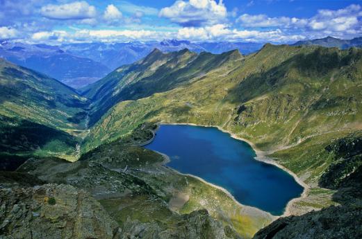
Autumn in Valtellina is a magical time. This proposal is among the easiest walks in the area, but is still able to fully capture the beauty of the colors of this season. It is a path for everyone that starts from the village of San Martino, enters the Forest of Bagni di Masino until it reaches the old thermal structure.Walking in the silence of the small forest area, it is possible to admire tall colorful beech trees, huge erratic boulders covered with green moss, birch trees with yellow tones and immense expanses of red leaves. The forest, within which you immerse yourself, is included in the Foreste di Lombardia circuit and consists of both the area around the Bagni di Masino municipality and the nearby Val di Mello. To reach the starting point of the hike, you have to take the SP9 and cross the entire Masino Valley until you reach San Martino. Once in the village it is possible to find several pay parking lots (7€ per day), the most convenient is definitely the one located next to the tourist office.Once you have parked your car you go to the info point and pass it, reaching the dirt parking lots located behind it. Going up the parking area you will easily spot a sign indicating "Bagni di Masino". You then take the only path present (CAI 455) immediately plunging into the woods and walking on a wonderful colored carpet of leaves and moss. The autumn colors are already clearly visible, but what is most striking are the huge granite boulders entirely covered with green moss and scatteredly arranged among the large beech and fir trees. In certain parts of the trail these rocks bend in on themselves, going on to create striking caves and small tunnels that are often crossed by the trail. After a 30-minute walk, near the campsite, you reach the first parking area in the valley. In this area the forest widens a bit, opening up the view of the mountain ranges that surround the valley. The mountains are not particularly high, but all their walls are literally covered with small patches of color: the trees manage to grow on the slopes, and at this time their golden foliage creates a truly unique spectacle. The light fog I found during my hike only made it even more impressive. The trail now continues level on a wide dirt road and then enters an area full of gravel and rocks. However, the trail is always clearly visible and very easy to follow. It continues on a slight incline, back into the woods, until it reaches the paved road. Almost the entire route is to be walked on a normal mountain trail, but there are a couple of sections where it is necessary to walk a few meters even on asphalt. Since the end point is also directly accessible from the road, it is possible to decide to exit the trail to walk along the roadway. After passing a narrow hairpin bend in the road, before taking the path again that cuts right into a meadow, you can veer to the right to reach one of the most spectacular points of the entire walk. In this area the forest becomes practically flat, and the small streams flowing between the rocks generate shallow pools of clear water. Looking up you can see a myriad of huge boulders almost entirely covered by a cloak of wet moss, and just beyond, small shrubs, beeches and huge firs go to cover the sky with their foliage creating a magnificent explosion of bright greens, oranges and deep reds. The advice, therefore, is to leave the proposed trail briefly and wander through this fairy-tale-toned grove to go for new vistas and different colors. After a long break you can resume the walk, the trail in this section begins to cut through the drawn hairpin bends of the road, allowing you to arrive much more quickly at an elevation of 1,150 m. With each new step it seems that the colors want to light up more and more, but it is when you reach the asphalt road again that the most beautiful spectacle of the Bagni di Masino Forest is shown. Here the asphalt is literally swallowed up by a fiery red forest, the fallen leaves completely cover the side of the road and the immense trees close in on themselves going to create a huge natural tunnel. It seems as if we have entered a painting that is too good to be true, and one cannot help but admire with open mouth what nature is giving us. While walking along the roadway is really inviting (you will do it on the way back), the trail now involves veering to the left and climbing up the steep forest. This is probably the most complex part of the entire hike, but it requires only a few minutes of effort, as the trail almost immediately stops climbing and returns to level ground. The forest is particularly dense, and the foliage of the trees will easily keep you out of the sun or light rain. What is most astonishing, however, is that an endless carpet of red leaves completely covers the entire area, going almost entirely to hide the ground. This kind of situation obviously cannot last for many days, and one must be lucky enough to be there towards the end of autumn, before the first snowfall. Walking on level ground one remains in this fairy-tale setting for several minutes, until one reaches the end of the forest. Here begins a short tourist trail, called the "sensory trail," which is very wide and stretches alongside the old spa complex. The trail is divided into nine stages with special notice boards, which display information about the local flora and fauna. Leaving the woods, take the wide path that turns immediately left and leads close to the creek. The section is very well maintained: there are several benches where you can stop, a wooden handrail separates the path from the creek, and the bottom is free of potholes or roots. After a few steps, you can already see a notice board that has some useful information about the roe deer, alpine chamois, brown bear, fox, marten, and gigiàt. The first 5 are animals that inhabit these mountains and that you can see if you are lucky enough; the last on the list, on the other hand, is a mythological creature considered the symbol of the valley. It is reportedly a huge and frightening animal, a cross between a billy goat and a chamois, however, the evidence is not very clear. A depiction of it can be seen on the wall of a house at the beginning of Ezio Vanoni Street in San Martino. The painting is accompanied by the following phrase : "El Gigiat, nume tutelare de esta splendida valle. Good to the man who nature respects, bad luck to those who find him disrespectful. Honors and glory to those who would see el and news of it." Continuing on we come to a large clearing bordered on the right by the Masino stream and filled with the ever-present erratic boulders. There are several small tables with cooking areas, so this is the perfect place to stop for something to eat. At the edge of the meadow is the tourist office and a curious construction consisting of 4 monoliths, formed by the 4 main minerals of the valley. When I was there a light drizzle and cold wind did not make the break too relaxing, in summer however this place is absolutely perfect to stay a little cool and breathe mountain air. Before heading back, it is possible to pay a quick visit to the small waterfall that generates the stream. To reach it, simply pass the picnic area by turning right. Here a sign will indicate that the waterfall is only a 5-minute walk away. You will then continue through a wide meadow surrounded by golden yellow-leafed birch trees and, after a very short climb, you will begin to hear the roar of the water on the right. The waterfall is not huge, but the context within which it is set is truly splendid: colorful trees and dark rock blend to create a beautiful play of contrasts, further enhanced by the blue reflections of the water that accumulates in small pools. The waterfall is the upper limit of the hike and now all that remains is to return to the parking lot. On the way back, however, it is possible to take a couple of detours to see two other really interesting spots. Returning from the waterfall one turns left with the goal of bypassing the spa building from the opposite side. After a few steps you come to an ancient little rock bridge invaded by the ubiquitous moss, which also climbs here. Crossing the bridge, one begins to skirt the structure of the former baths until reaching a small cave where from a small fountain, spring water at 38 °C flows out. Legend has it that this spring was discovered by a shepherd who, determined to investigate why one of his cows was making much more milk than the others, followed her to this area until he discovered that the animal was drinking from this spring. If the story were true, however, this would be a very old fact; in fact, the thermal waters in the valley had been known since the 1400s and over the centuries had attracted nobles from various Italian and Swiss cities. The Bagni di Masino spa that can be seen today was in operation for several years. Since 2015 the facility has been closed due to geological hazards in the area. After warming up at the spring, one can continue until reaching a bulletin board marked "Val Masino." The following section allows you to rejoin the path taken on the outward journey; however, the advice is to turn right to enter the spa garden until you reach the small parking area at the end of the paved road. This detour from the dirt path serves to return to the beautiful red forest admired earlier. Walking on the roadway rejoins the path taken on the way out much more quickly, and you also get to visit this part of the forest in its entirety, which is probably also the most characteristic. So take time to admire the immense trees, the beautiful undergrowth, the red carpet of leaves, and the rain-soaked rocks invaded by moss. Although there is no precise path, it is still possible to get off the road and into the flatter areas of this fantastic color-laden picture. After a long break to take photographs you return to the beginning of the wooded area and, turning left, take the outward path again. In about 1 hour you reach the parking lot again. - Ph: Stefano Poma