Mount Lesima
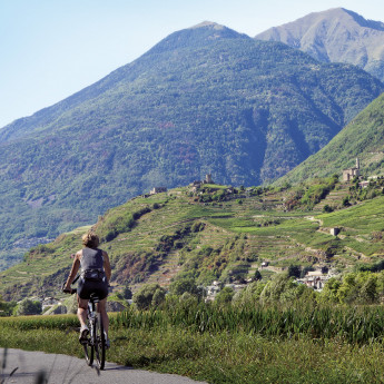
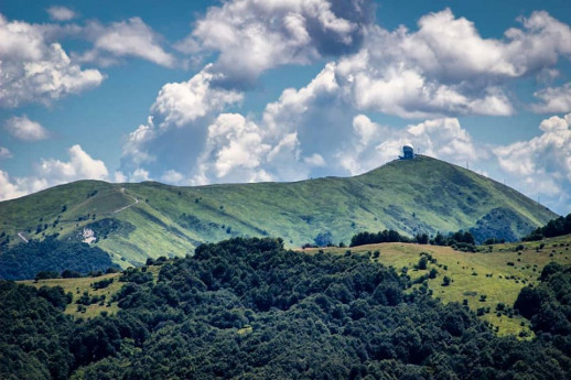
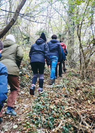
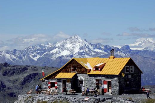
The Le Torraie – Monte Lesima Nature Reserve and SCI (Site of Community Importance) extends over 598 hectares along the Torraie valley in the municipality of Brallo di Pregola, from the courses of the Avagnone and Trebbia streams to the 1,724 meters of Lesima's summit. Geologically, the site is characterized by the limestone of Monte Antola and the Corbesassi cliff. The reserve hosts hundreds of hectares of beech forests at higher altitudes and black hornbeam at lower altitudes. Along the ridge, there are extensive meso-xerophilous meadows of significant natural value, rich in species (orchids are abundant) and interactions with the pollinators that visit them. There is a station of Astragalus sirinicus, the northernmost in the Italian peninsula. Due to its geographic location, Monte Lesima (whose summit is less than 40 km in a straight line from the Gulf of Tigullio and the Gulf Paradiso) is influenced by Mediterranean climatic conditions despite being in a continental climate. The wildlife includes river crayfish, many diurnal raptors, including the golden eagle and the short-toed eagle, and among mammals, deer and wolves. Thanks to over 80 recorded species, the Lesima area is one of the richest in butterflies in Europe. Monte Lesima is the highest peak of the Ligurian-Piedmontese-Pavese Apennines. It is recognizable by the presence of a radar used for air navigation and the large summit cross. The western slope offers steep, grassy sides; to the east, it is steep and rugged. It dominates the valleys of the Trebbia and the Avagnone stream, its left tributary. "From the summit, there is an extensive view of the surrounding valleys and the entire Ligurian-Piacenza Apennines. One can recognize the Dego and Oramara mountains, part of the range between the Trebbia and Aveto; the Bue, Maggiorasca, Penna, and Ajona mountains, where the watershed between the Aveto and Taro runs. Between Lesima and Alfeo, the Boreca stream flows in a winding, rugged valley, one of the most fascinating in the entire Apennines" (from "Un'isola tra i monti" by Fabrizio Capecchi). On the clearest days, a glimpse of the Ligurian Sea can be seen. VISIT INFORMATION ON FOOT OR BY MOUNTAIN BIKE The Nature Reserve/SIC is accessible upon request via a dense network of trails, which can be traveled on foot or by mountain bike. Recommended Access Points: • Prodongo - Piani di Lesima • Brallo Giovà carriage road • Rovaiolo Vecchio • Piani di Cavanna BY CAR Brallo di Pregola can be reached by traveling the entire Staffora Valley from Voghera. Alternatively: via the SS 412 of Val Tidone, passing through Castelsangiovanni, Borgonovo Valtidone, Romagnese through the Scaparina Pass via the Trebbia Valley from Bobbio, crossing the Penice Pass, or from Cerignale (Ponte Organasco) CONTACTS Province of Pavia: +39 0382 597788Email: provincia.pavia@pec.provincia.pv.itMunicipality of Brallo di Pregola: +39 0383 550040Email: comune.brallodipregola@legalpec.it COVER PHOTO BY AUNPASSODALLAVETTA
 to Milan")