Along the Tees, in the valley of the sheep
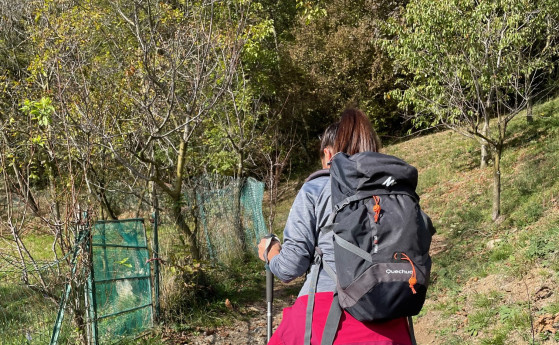
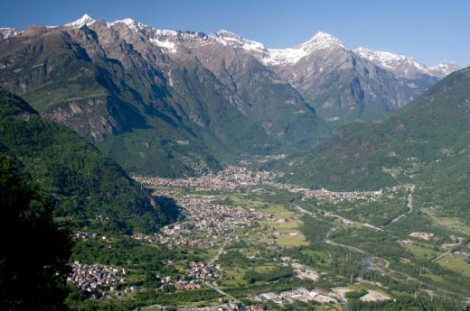
This itinerary is characterized by the presence of the Tee, very atmospheric old wooden dwellings used in the past by shepherds during the summer period, now largely restored. The Tees are characteristic of the Federia Valley, a valley little frequented in winter since it lacks ski lifts and ski slopes but which deserves to be known and experienced for its splendid snowy landscapes. The trail that will feature them can be easily walked with snowshoes on your feet, along a clearly visible path that is constantly marked by green and red poles. The ideal time to start the trail is mid-morning when the sun shines on it and the air warms up; moreover, the valley lies behind a high promontory that, in the winter season, hides the sun as early as around 2 p.m., while the valley flooris never irradiated. It is advisable not to overdress for the first stretch since it is very sunny and uphill, but to cover up well on the return stretch since the temperature difference is significant. Val Federia literally means "the valley of the sheep," in fact in the not-so-distant past this area was mainly managed by shepherds whose pastures extended over nearly 63,000 hectares. The valley was also an area of great commercial value due to the numerous mountain passes, the most important of which is the Cassana Pass. The latter connects the Livigno area with the Engadine, a pass rich in history especially in the context of the Valtellina Wars (1620-36) in which the three Grey Leagues attempted to retake Valtellina and the Contadi di Chiavenna and Bormio after the 1620 uprising of Catholic nobles. One must leave one's car at the P3 parking lot in Ponte Calcheira, then walk along the road for a few tens of meters until reaching, on the right, the beginning of the path appropriately marked by a green sign with the symbol for snowshoe routes. Going uphill into the beautiful larch forest flanked by the Valle del Saliente stream, you follow the path without any difficulty, being clearly visible and marked thanks to the green-colored sign posts. The first part of the ascent is rather steep but nothing challenging, and in a short time, after a relaxing hike through the woods, you come out into the open skirting the first characteristic wood and stone huts. The slopes in this section become easier and, as you climb, the alpine landscape opens to 360 degrees giving unique emotions. Behind you can admire the northernmost side of Livigno set by snow-capped mountains, but the most spectacular view is the one that opens up in front of you and that reveals itself little by little along the walk showing the valley at every angle. Along the way you can see the footprints left in the snow by wild animals, and, for the more enthusiastic, it is fun to try to find out which species they belong to.Reaching the highest part of the walk, about 2050 m above sea level, the trail continues slightly downhill, soon entering a larch forest. Once you get out of the forest, you pass some huts: in the distance, at the bottom of the valley, with its 3050 m altitude towers Pizzo del Leverone whose view leaves you speechless. A few souvenir shots and you continue until you reach a left turn, just beyond a beautiful Tea, the Tea da Memi, a pleasant refreshment point where you can enjoy traditional, homemade dishes.At this point the section that leads back to the parking lot begins. In the first few meters you have to pay some attention because the path continues along a short but steep descent. When you reach the bottom, you turn left, skirting the road for a short distance at first, after which, just before the beautiful little church of Federia, you usually have to take off your snowshoes since you have to continue for about 500 meters along the road, which is completely frozen in winter. Just before a nucleus of huts, on the right is the green marker indicating the final section of the trail, you must put your snowshoes back on and continue downhill along the Federia stream until you reach the Calcheira bridge from where the walk began. Important: According to new regulations, for ski mountaineering and snowshoeing activities, starting January 1, 2022, it is mandatory to carry the Artva device including rescue shovel and probe (for possible avalanche or avalanche danger).


 - Villa Melzi d’Eril")
")