I found 123 results for navigli

Pavia in a weekend

On the trail of the Longobardi or among the cloisters of the University, without forgetting flavors and traditions

Grazie

Groups of houses leaning against the Sanctuary of the Madonna delle Grazie
Grazie

Pinacoteca Tosio Martinengo Art Gallery

Recently returned to Brescia’s citizens after being closed for 9 years, Pinacoteca Tosio Martinengo reopens to the public presenting a new layout and extremely important works of art, from the Renaissance and its main representatives like Raphael and Lotto to the greatest 19th century painters.   This museum brings Brescia more and more at the centre of cultural and tourist itineraries in Lombardy and northern Italy. From Raphael and the Renaissance to Hayez and Romaticism Particularly illustrious names displayed at Pinacoteca are Canova, Hayez, Raphael, Ceruti, and Lotto. It’s a rich, diversified collection of priceless paintings, including grandiose works by Raphael (Virgin Mary with Baby Jesus, the Angel, the Blessing Christ) which return to Brescia after being displayed in the most important museums worldwide, including National Gallery in London, while Pinacoteca was closed. In addition to the paintings, Pinacoteca also contains sculptures, jewelry, enameled objects, and medals. The collection of Brescian Renaissance painters is absolutely noteworthy: Moretto, Romanino, Savoldo, Foppa are among the undisputed protagonists of this artistic period and their work is inextricably linked to the region of Brescia. A completely renewed exhibition layout Pinacoteca Tosio Martinengo has a new, modern appearance. The old Martinengo da Barco palace, built in the 1500s, was restorated and adjusted to host the 21 completely renovated exhibition rooms: tapestry and velvet welcome visitors with a colorful explosion of blue and red, green and silver, before they embark in an engaging, outstanding museum experience comparable to that offered by the main European museums. The renovation has made the museum easier to navigate, while absolutely respecting the original architecture and structure of the building. Pinacoteca Tosio Martinengo: hours and information Pinacoteca Tosio Martinengo is in Piazza Moretto and is open from Tuesday to Sunday at: 1st October – 15th June: 9am to 6pm (10pm on Thursday night); 16th June – 30th September: 10:30am to 7pm (10pm on Thursday night). For reservations and information on individual and group tickets, visit the museum page at Fondazione Brescia Musei website.
Pinacoteca Tosio Martinengo

Infopoint Basso Lago d'Iseo and Valcalepio

The Basso Lago d'Iseo and Valcalepio Infopoint is managed by the Pro Loco Sarnico-APS.The qualified staff is available for any information regarding the Basso Sebino area and the Province in general.   Our task is to provide tourists and citizens with all the information they need to fully experience the area in which we operate. Services offered:- tourist reception;- tourist information regarding the major tourist attractions of Lake Iseo and more generally of the entire province;- information on accommodation facilities in the area;- information on events and shows;- publication and distribution of tourist materials, pamphlets, brochures and maps, transportation schedules, calendars of events organized in the Lower Sebino area. Other services:- Ticket office for Lake Iseo Navigation;- Public Desk and Nautical Records Office for The Lake Basin Authority of Lakes Iseo, Endine and Moro. The territory of Basso Sebino includes the southern part of the Bergamo side of Lake Iseo and the immediate hinterland, almost all of which is occupied by steep hills and mountains rising from an altitude of 197 m above sea level at Sarnico to 753 m above sea level at Parzanica to the summit of Mount Bronzone, 1,334 m above sea level. The villages included are: Adrara San Martino, Adrara San Rocco, Castelli Calepio, Chiuduno, Credaro, Foresto Sparso, Gandosso, Grumello del Monte, Parzanica, Predore, Sarnico, Tavernola Bergamasca, Viadanica, and Vigolo, for a total territory of about 123 km2 and a total of about 53,000 inhabitants.The small settlements, linked by common historical events, are united by a precise environmental identity: Lake Iseo (or Sebino). The beauty of the places, happily defined as "between the mountains and the lake," is also reflected in the historic villages with elements of fortress structures, sanctuaries and extraordinary art treasures. The communities facing the lake combine architectural elements of ancient nobility, traces of industrial archaeology and modern tourist facilities, while the hinterland allows the happy discovery of a rural and mountain civilization in many respects still intact.The Lower Sebino is, moreover, all to be discovered for its food and wine, typical products (cheese, salami, honey, wine, olive oil...), trekking along hilly paths, water sports, cultural and folkloric events.

Wine Bike Tour 2- Adrenaline

A beautiful trail, suitable for people who are moderately trained
Wine Bike Tour 2 - Adrenaline

Milan, following Leonardo’s footsteps

Pictorial suggestions and drawings. Machines and impressive hydraulic engineering works. In Milan, a journey in the wake of Leonardo

Borgarello

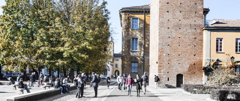
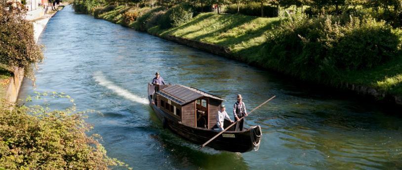
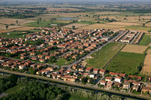
B Orgarello is located in the Pavese area, in the plain north of Pavia, along the Naviglio Pavese. During the Visconti era, it was included in the Parco Nuovo, a vast hunting estate between the Castle of Pavia and the Certosa.   THE VISCONTI PARK Originally known as Barco (Barcho Vecchio) of Pavia, it covered an area of 14 km² with a perimeter of 15 km. It was created by Galeazzo II Visconti after 1360 and enclosed by a brick wall 4 braccia (approximately 2.5 meters) high. The park stretched northward from the city up to Cantone delle Tre Miglia (Borgarello), San Genesio, and Due Porte. Around thirty years later, his successor Gian Galeazzo expanded the park to 22 km², extending it from three to five miles northward. He built a new wall to enclose Torre del Mangano, Porta d’Agosto, Ponte Carate, and Porta Chiossa. By 1399, the perimeter wall was completed: nearly 25 km long, with a thickness of three brick heads (around 90 cm), foundations 2 braccia (about 1.25 meters) deep, and a total height of 5 braccia (around 3 meters), including a small roof on top. The construction and maintenance of the park required extensive hydraulic engineering, sophisticated for its time, anticipating Leonardo da Vinci’s works, much like the Milanese canals. The park was rich in forests of oaks, chestnuts, alders, and elms. It was a vast hunting garden where nature and human ingenuity were intertwined in a harmonious landscape. Many ancient place names were altered to glorify the new ruling family, with few exceptions—such as Borgarello—and the dedications of the two churches in Borgarello and Torre del Mangano to two "warrior saints": Saint Martin of Tours, linked to pilgrimages, and Saint Michael, a figure traditionally connected to the Lombards. The gates of the park still bear their historical names after more than six centuries, even though traces of older dedications have been lost. Following Ludovico il Moro’s fall in 1500, the park began its decline. After the Battle of Pavia in 1525, numerous breaches were made in the walls, and large sections were either collapsed or dismantled by local farmers for reuse, leading to the park’s eventual complete demolition. THE NAVIGLIO PAVESE Begun in the 16th century under Spanish rule but later abandoned, the canal project was revived during the Napoleonic era and completed under the Austro-Hungarian government in 1819. Until the post-World War II period, it was crucial for irrigation and navigation. Barges, pulled by horses, transported gravel from the Ticino River to Milan’s Porta Ticinese port, and occasionally even passengers willing to endure a long but pleasant journey. Navigation was facilitated by the canal’s gentle slope and the presence of locks, designed with Leonardo-inspired engineering, to manage elevation changes. The towpath along the Naviglio was historically known in 15th- and 16th-century documents as the “Duke’s Path” or the “Lord’s Path.” Until recent times, where the bridge now stands, a granite parapet marked Borgarello’s overlook onto the towpath, known as the “sasso.” This gave rise to the local saying, “d’la Rüsa al Sass,” referring to the village’s easternmost and westernmost boundaries. Today, a cycling path runs along the Naviglio Pavese, following the waterway for 30 km from Milan to the Certosa di Pavia and continuing another 6 km to Pavia’s historic center. CASCINA REPENTITA Remnants of the ancient Visconti Park can still be seen at Cascina Repentita, which was already documented with this name in a deed from 1111. The name likely derives from its historical role as a refuge for “repentant prostitutes of Pavia” during the early Middle Ages. The farmhouse is situated on the rural road connecting Cantone Tre Miglia to the villages of San Genesio and Mirabello. It features the typical square base of Lombard rural buildings, though it has undergone modifications and is now in poor condition. Nestled among rice fields and near the railway line, it became famous thanks to Francis I, King of France. This farmhouse holds significant historical importance—look for the plaque that explains why. Legend has it that Zuppa alla Pavese was invented here by a local peasant woman as an improvised dish. Do you know the recipe? The battle between the French and the Spanish began “at the break of dawn.” Close your eyes and imagine the colors and sounds of the battlefield. According to tradition, after his defeat, Francis I wandered through the countryside, exhausted and hungry. He is said to have uttered the famous words: “All is lost, save honor and my life, which is spared.” A peasant woman saved his life by offering him food. “At the fireplace, a broth of barlande (borage) was simmering, but no meat—then a rare commodity. She took a slice of homemade bread, baked the previous Sunday in the communal oven, and a fresh egg.” The king was so impressed that he later introduced this simple yet delicious soup at the French court, where it became a celebrated dish with a legacy lasting for centuries. SOURCE: Municipality of BorgarelloPHOTO: "Villa in Comune" Committee  

Lago di Como:Bellagio, the pearl

One of the world's best-loved places, Bellaggio lies on the tip of the central headland, offering convenient ferry access to both branches of the lake
Lago di Como: Bellagio, la perla

From Lecco to Milan following the Adda

From Lecco to Milan following the Adda

Mantua Infopoint

Mantua, a city of art and culture with timeless charm, a treasure chest of wonders surrounded by lakes, in the 'enchanting setting of the Mincio Park.

Mount Lesima

The Le Torraie – Monte Lesima Nature Reserve and SCI (Site of Community Importance) extends over 598 hectares along the Torraie valley in the municipality of Brallo di Pregola, from the courses of the Avagnone and Trebbia streams to the 1,724 meters of Lesima's summit. Geologically, the site is characterized by the limestone of Monte Antola and the Corbesassi cliff. The reserve hosts hundreds of hectares of beech forests at higher altitudes and black hornbeam at lower altitudes. Along the ridge, there are extensive meso-xerophilous meadows of significant natural value, rich in species (orchids are abundant) and interactions with the pollinators that visit them. There is a station of Astragalus sirinicus, the northernmost in the Italian peninsula. Due to its geographic location, Monte Lesima (whose summit is less than 40 km in a straight line from the Gulf of Tigullio and the Gulf Paradiso) is influenced by Mediterranean climatic conditions despite being in a continental climate. The wildlife includes river crayfish, many diurnal raptors, including the golden eagle and the short-toed eagle, and among mammals, deer and wolves. Thanks to over 80 recorded species, the Lesima area is one of the richest in butterflies in Europe. Monte Lesima is the highest peak of the Ligurian-Piedmontese-Pavese Apennines. It is recognizable by the presence of a radar used for air navigation and the large summit cross. The western slope offers steep, grassy sides; to the east, it is steep and rugged. It dominates the valleys of the Trebbia and the Avagnone stream, its left tributary. "From the summit, there is an extensive view of the surrounding valleys and the entire Ligurian-Piacenza Apennines. One can recognize the Dego and Oramara mountains, part of the range between the Trebbia and Aveto; the Bue, Maggiorasca, Penna, and Ajona mountains, where the watershed between the Aveto and Taro runs. Between Lesima and Alfeo, the Boreca stream flows in a winding, rugged valley, one of the most fascinating in the entire Apennines" (from "Un'isola tra i monti" by Fabrizio Capecchi). On the clearest days, a glimpse of the Ligurian Sea can be seen. VISIT INFORMATION ON FOOT OR BY MOUNTAIN BIKE The Nature Reserve/SIC is accessible upon request via a dense network of trails, which can be traveled on foot or by mountain bike. Recommended Access Points: • Prodongo - Piani di Lesima • Brallo Giovà carriage road • Rovaiolo Vecchio • Piani di Cavanna BY CAR Brallo di Pregola can be reached by traveling the entire Staffora Valley from Voghera. Alternatively: via the SS 412 of Val Tidone, passing through Castelsangiovanni, Borgonovo Valtidone, Romagnese through the Scaparina Pass via the Trebbia Valley from Bobbio, crossing the Penice Pass, or from Cerignale (Ponte Organasco) CONTACTS Province of Pavia: +39 0382 597788Email: provincia.pavia@pec.provincia.pv.itMunicipality of Brallo di Pregola: +39 0383 550040Email: comune.brallodipregola@legalpec.it COVER PHOTO BY AUNPASSODALLAVETTA  

From Lecco to the Martesana Canal

Woods and canals studied by the Renaissance Genius. Inspiring mountains. Ferries that operate with the current.
Borgo di Pescarenico on the Adda river